Weather
Warmer, showery days for the Heartland

Much of the country will not receive heavy precipitation during the next couple of several days.
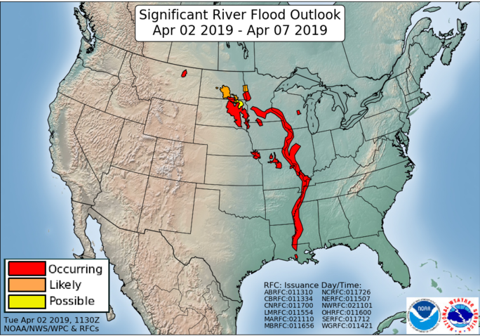
Mostly dry weather will be especially favorable across the northern Plains and upper Midwest, where a mid- to late-week warming trend will release additional runoff (due to melting snow) into already swollen rivers.
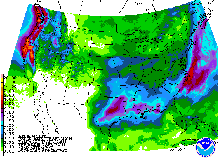
Exceptions to the tranquil weather pattern will include the Southeast, where a pair of storm systems will produce as much as 1 to 2 inches of rain, and the northern two-thirds of the West. In the latter region, periods of heavy precipitation in northern California and the Pacific Northwest will include some high-elevation snow.
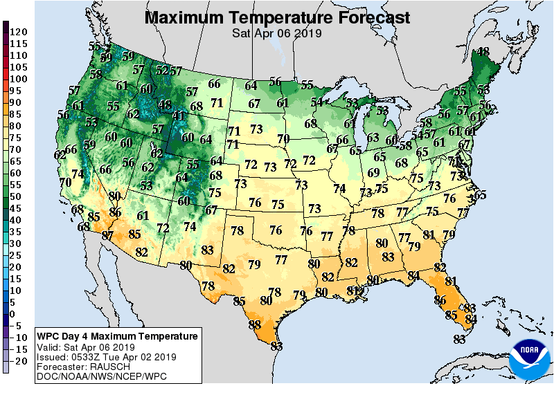
Elsewhere, most of the country will experience a reversal in temperatures, with warmer-than-normal weather expected nearly nationwide by week’s end.
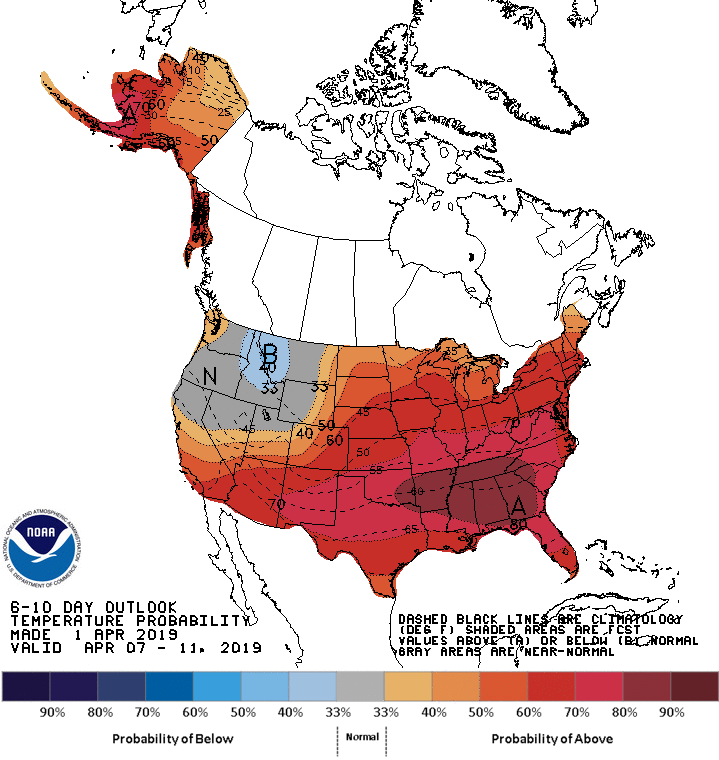
Looking ahead, the 6- to 10-day outlook calls for near- or above-normal temperatures and precipitation across the entire country.

The greatest likelihood of warmth will cover the Mississippi Valley and the mid-South, while the odds for wetness will be greatest across northern California and the Pacific Northwest.
Add Comment