Weather
Rains to diminish; cool days ahead for the Heartland
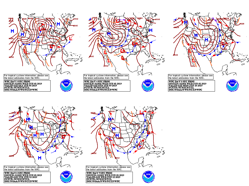
An active weather pattern will return across much of the country during the next several days, as a pair of storms interact with tropical moisture.
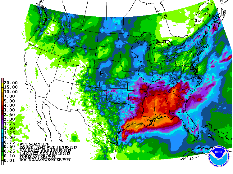
Five-day rainfall totals could exceed 10 inches along the Gulf Coast from southeastern Texas to western Florida, while a much broader area from the southeastern Plains into the Southeast should receive at least 2 inches.
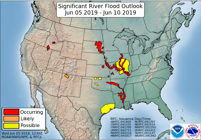
Flooding could worsen in the middle and lower Mississippi Valley, but parts of the Southeast will experience drought relief.
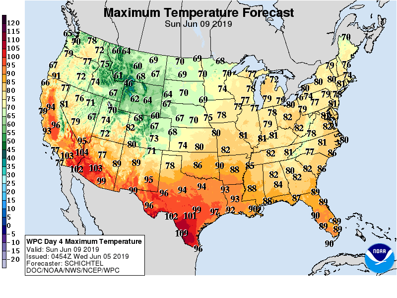
Elsewhere, dry weather will prevail in the Southwest, while, occasional showers will precede and accompany a cooling trend across the northern one-third of the U.S.
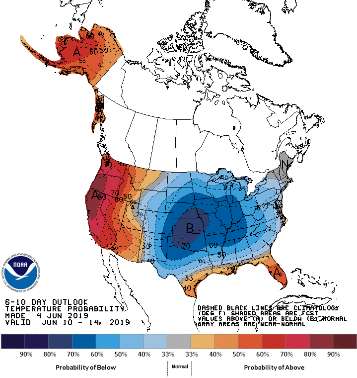
Looking ahead, the 6- to 10- day outlook calls for near- or below-normal temperatures across much of the central and eastern U.S., while warmer-than-normal weather will prevail along the Gulf Coast and west of the Rockies.
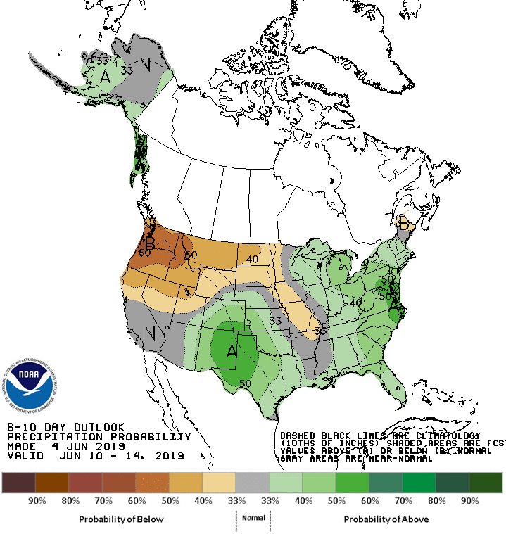
Meanwhile, near- or above-normal rainfall across most of the country will contrast with drier-than-normal conditions from the Pacific Northwest to the northern Plains.
Add Comment