Weather
Powerful late-season storm to sweep the Heartland
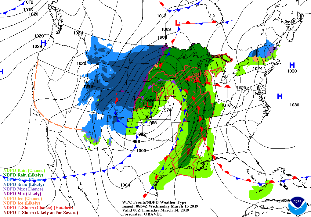
A powerful, slow-moving storm will cross the central Plains Wednesday and the upper Midwest on Thursday. By Friday, the low-pressure system will begin to weaken over eastern Canada, while a trailing cold front will move through the eastern U.S.
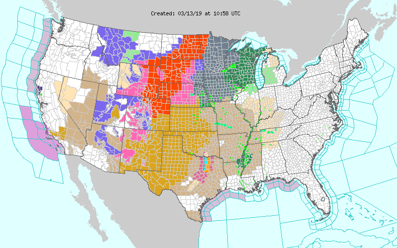
From northeastern Colorado into parts of the Dakotas, blizzard conditions will result in significant livestock stress (during calving season) and major travel disruptions.
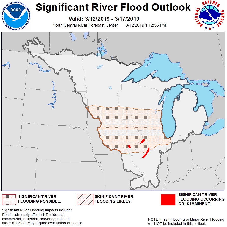
Meanwhile, rain and melting snow in portions of the western and northern Corn Belt could lead to moderate to major flooding, locally aggravated by ice jams.
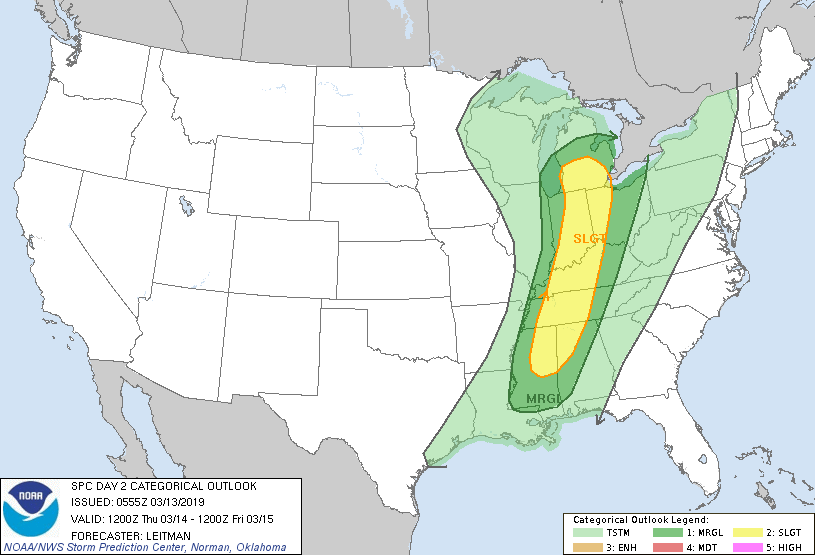
Finally, locally severe thunderstorms will sweep across the South, while high winds will rake the central and southern Plains.
Late in the week, in the storm’s wake, cool but tranquil weather will cover much of the country, although a warming trend will commence in the Far West.
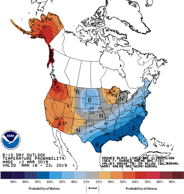
Looking ahead, the 6- to 10-day outlook calls for the likelihood of above-normal temperatures in the upper Great Lakes region and much of the West, while colder-than-normal conditions will prevail on the northern Plains and along and southeast of a line from Texas to Maine.
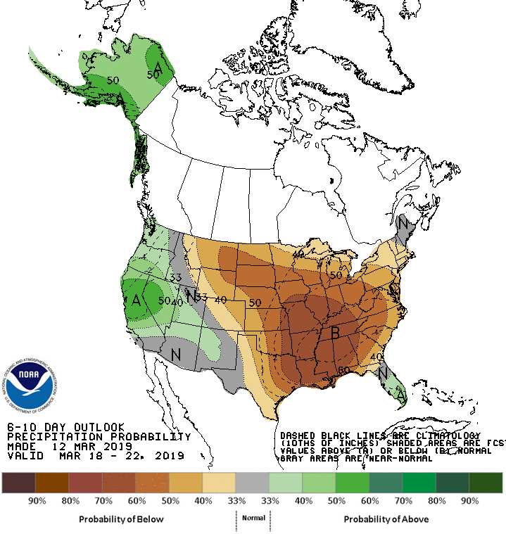
Meanwhile, below-normal precipitation across most of the central and eastern U.S. should contrast with wetter-than-normal weather in southern Florida and the Far West.
Add Comment