Weather
Heat & humidity to dominate the Plains, Corn Belt
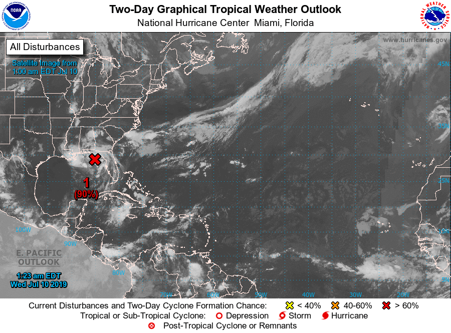
A low-pressure system centered over the northern Gulf of Mexico will continue to acquire tropical characteristics and should become a named storm (Barry) later this week.
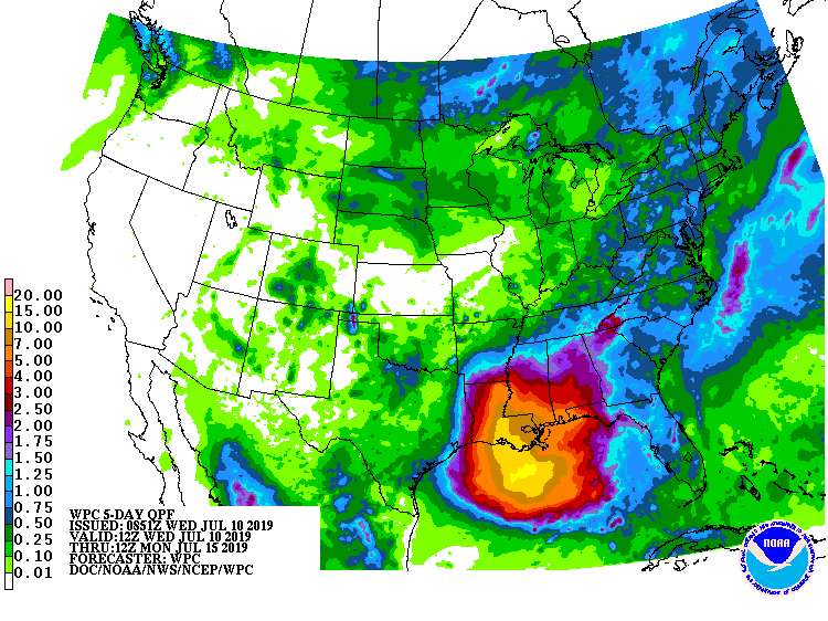
Regardless of development, excessive rainfall should occur in the central Gulf Coast region and environs, with 5-day totals expected to exceed 10 inches in some locations. A
A broader area of the South and East will experience locally heavy showers, in part due to the interaction between tropical moisture and a cold front. In contrast, only widely scattered showers will dot the Plains, Rockies, and upper Midwest, while dry weather will prevail in California and the Great Basin.
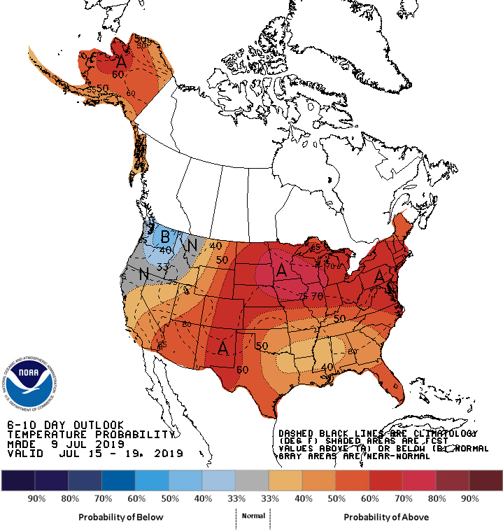
Looking ahead, the 6- to 10-day outlook calls for hotter-than-normal weather nationwide, except for near- or below-normal temperatures in the Northwest.
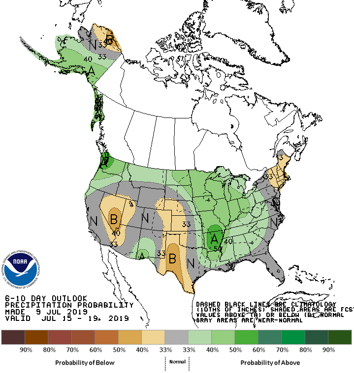
Meanwhile, near- or above-normal rainfall across most of the country, including the Mississippi Valley and the Midwest, should contrast with drier-than-normal weather in the Great Basin, the central and southern High Plains, and the Northeast
Add Comment