Weather
Cold wave to dominate the Heartland
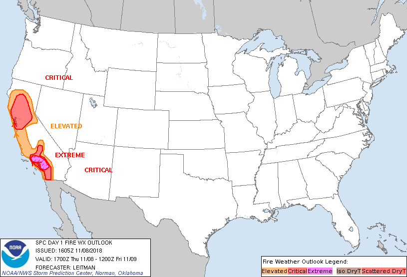 A Santa Ana wind event will persist during the next few days in parts of California, maintaining an elevated wildfire threat.
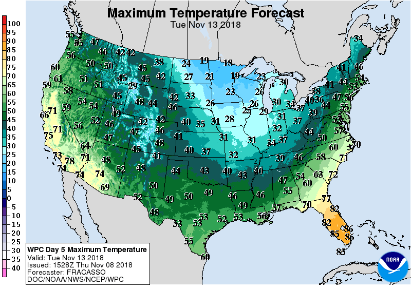 Warmth will accompany California’s offshore winds, but much of the remainder of the country will experience significantly below-normal temperatures. Meanwhile, snow will end later Thursday across the central Plains, but significant accumulations may occur during the next several days downwind of the Great Lakes.
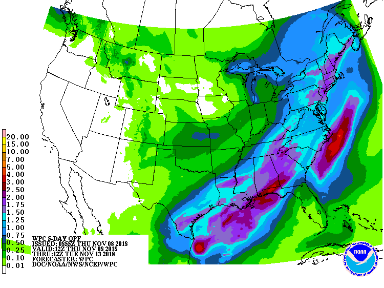 Farther south, late-week rainfall can be expected in the South and East, with 1- to 2-inch totals possible in many locations. In contrast, no precipitation will occur during the next 5 days west of the Rockies.
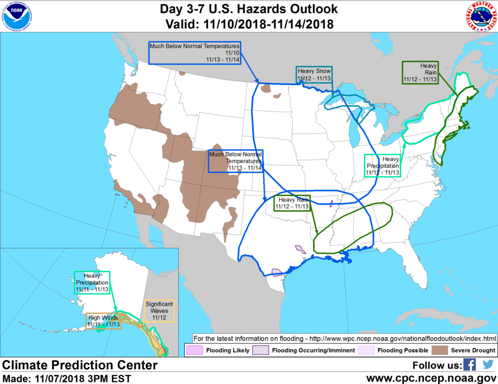 Looking ahead, the 6- to 10-day outlook calls for below-normal temperatures from the central and southern Rockies to the Atlantic Seaboard, while warmer-than-normal weather will be limited to the Far West. Meanwhile, below-normal precipitation across much of the western and central U.S. should contrast with wetter-than-normal conditions in southern Texas and the Atlantic Coast States.
Add Comment