Weather
A winter “look & feel” across the Heartland
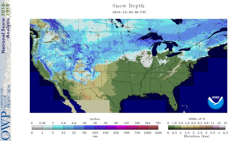
Across the Corn Belt, cold, mostly cloudy weather lingers. Substantial snow covers roughly the northern half of the Midwest, putting late-season corn and soybean harvesting on an indefinite hold. Monday early-morning snow depths include 6 inches in Minneapolis-St. Paul, Minnesota, and 3 inches in Grand Rapids, Michigan. In addition, most fields in the southern Corn Belt are too wet to support fieldwork activities, following recent heavy rain.

On the Plains, snow covers roughly the northern half of the region in the wake of back-to-back storms. The snow has halted late-season harvest efforts but is providing insulation for winter wheat. Monday early-morning snow depths include 8 inches in Grand Forks, North Dakota, and 5 inches in Billings, Montana. Meanwhile on the southern Plains, dry weather accompanies a gradual warming trend, favoring cotton harvesting and other late-autumn fieldwork.
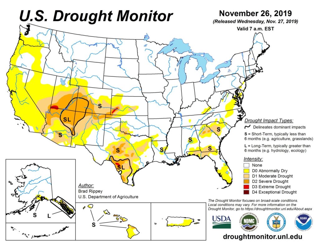
In the South, short-term dryness continues to intensify in several areas, including southern sections of Florida and Texas. In contrast, recent downpours have left fields soggy across much of the interior Southeast, including the Tennessee Valley and the northern Mississippi Delta, slowing or halting final harvest efforts for crops such as cotton and soybeans.
In the West, a storm system lurking offshore near the Pacific coast is producing locally heavy rain and high-elevation snow in northern and central California. Precipitation also extends inland across portions of the northern Intermountain West. Elsewhere, Thanksgiving week precipitation provided substantial drought relief in parts of the Southwest.
Add Comment