Weather
Temps to vary; wetter days to return
 Record-setting warmth will prevail west of the Rockies into the weekend, followed by a modest cooling trend. Mostly dry weather will accompany the Western warmth. Meanwhile, a series of cold fronts will sweep across the central and eastern U.S., sparking scattered showers and introducing progressively cooler air across the Plains and upper Midwest.
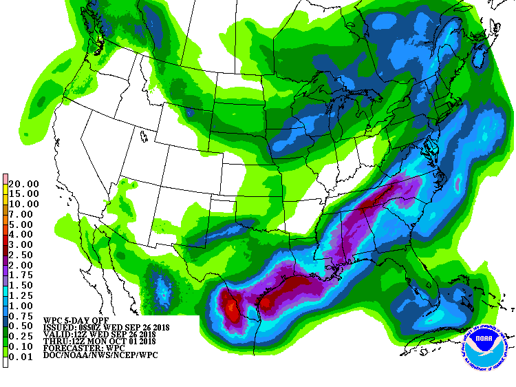 Five-day rainfall totals could reach 1 to 3 inches or more from the western Gulf Coast region into the middle and southern Atlantic States. Rainfall could top an inch in parts of the upper Midwest. Late-week and weekend freezes can be expected across the nation’s northern tier, starting across the northern Plains and eventually reaching northern New England.
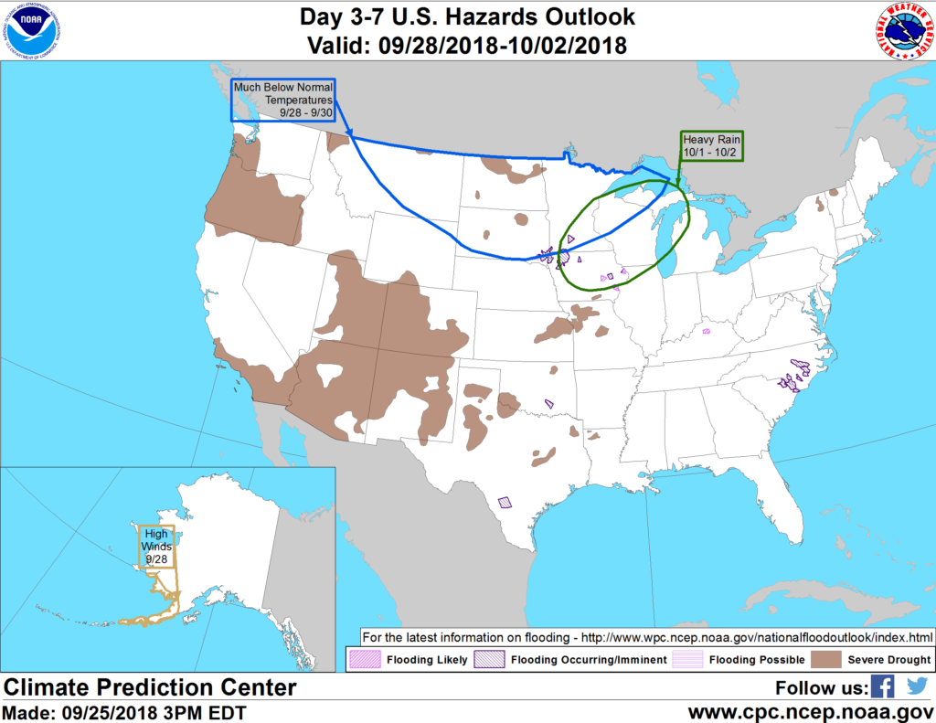 Looking ahead, the 6- to 10-day outlook calls for the likelihood of near- to above-normal temperatures and above-normal precipitation across most of the country. Cooler-than-normal conditions will be limited to the northern Plains, upper Great Lakes region, and northern New England, while near-normal rainfall will be confined to western Washington and southern Florida.
Add Comment