Weather
A change underway on the northern Plains, upper Midwest
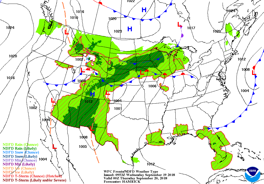 Across the Corn Belt, showers and thunderstorms are affecting the upper Midwest. Cooler air is arriving across the northern Corn Belt, but late-season warmth across the remainder of the Midwest continues to promote corn and soybean maturation. More than half (54%) of the U.S. corn crop was fully mature by September 16, compared to the 5-year average of 36%.
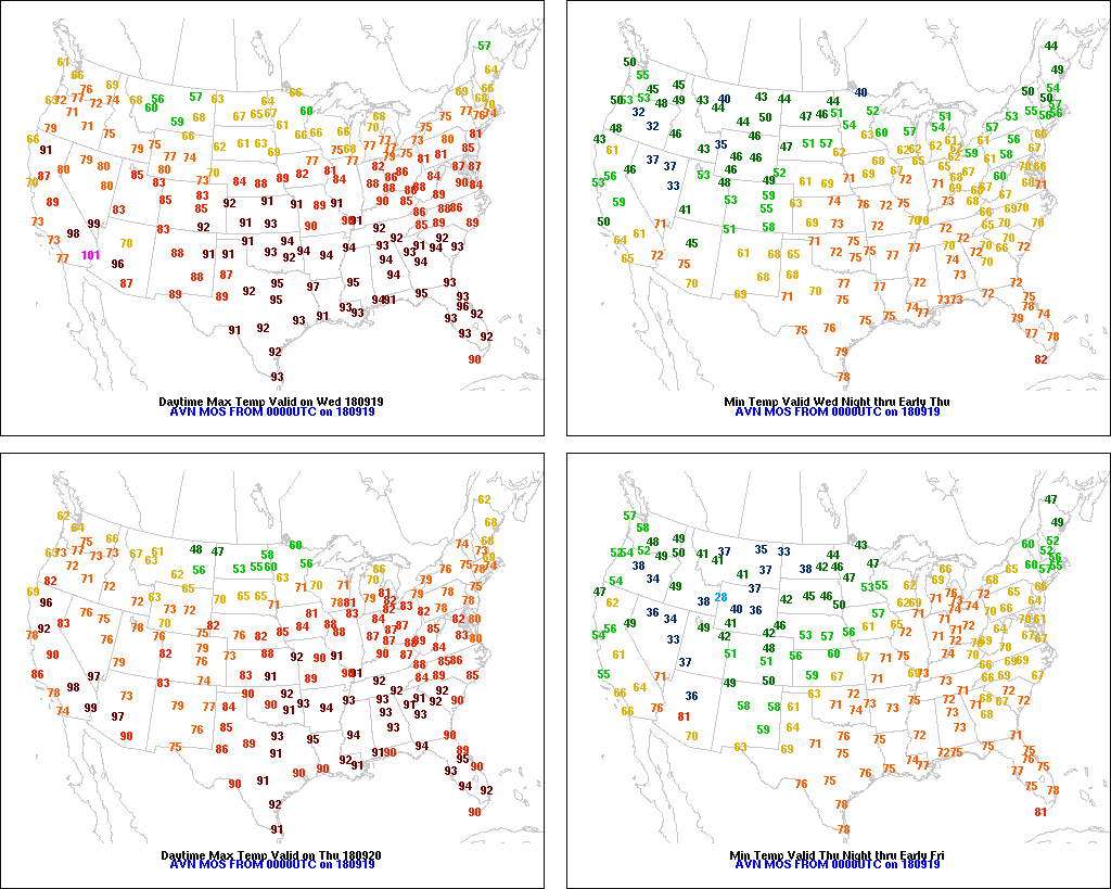 On the Plains, cool air is overspreading Montana and the Dakotas, accompanied by rain showers. Across the remainder of the Plains, hot, dry weather favors summer crop maturation and fieldwork, including harvest activities and winter wheat planting. Wednesday’s high temperatures should again exceed 95° as far north as the central High Plains.
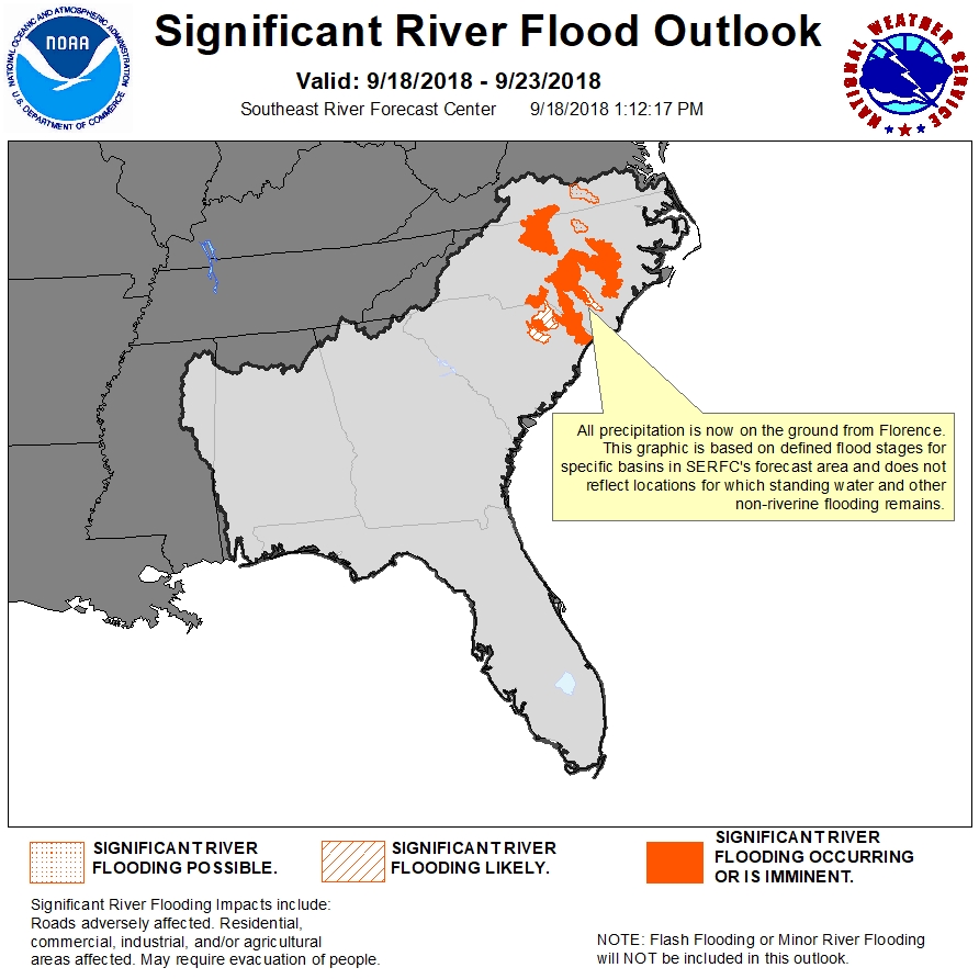 In the South, extensive flooding continues in eastern North Carolina and northeastern South Carolina. In North Carolina, for example, the worst flooding since September 1945 is affecting areas along the Cape Fear River, while the highest water levels since September 1996 are occurring along the Haw River. In areas not being affected by flooding, hot, dry weather is ideal for summer crop maturation and harvesting.
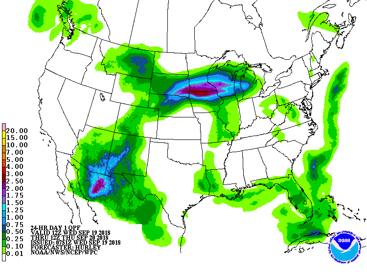 In the West, a late-season surge of monsoon-related moisture is producing showers in Arizona and New Mexico. Meanwhile, hot, dry weather covers the Great Basin and the Intermountain West. Extremely dry conditions persist in much of the Northwest, where rain is needed for recently planted winter wheat. In Oregon, where one-tenth of the winter wheat had been planted by the 16th, topsoil moisture was 93% very short to short.
Add Comment