Weather
Beneficial rains for much of the central, southern Plains, Corn Belt
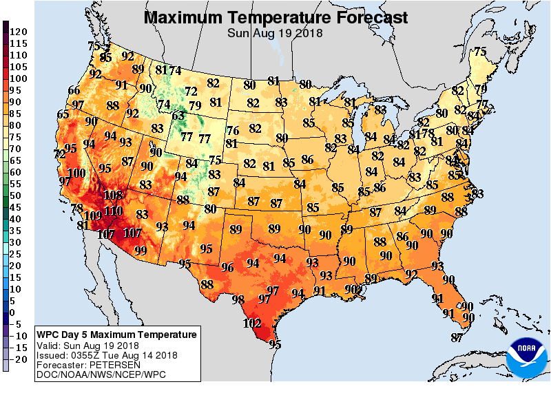 Late-summer heat will persist in the West and spread eastward across the nation’s northern tier, reaching the northern High Plains by mid-week and the Great Lakes region by week’s end. Meanwhile, showery weather will prevail across large sections of the country.
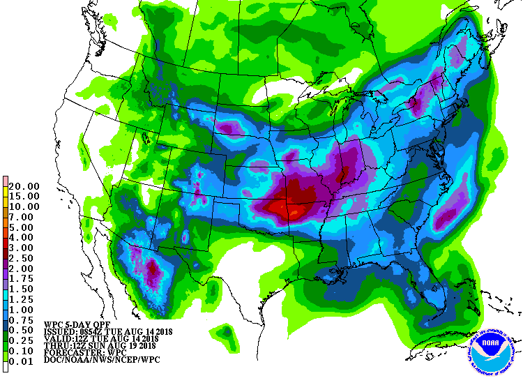 During the next 5 days, some of the heaviest rain (locally 1 to 4 inches or more) will fall from central sections of the Rockies and Plains into the southern and eastern Corn Belt. Similar totals can be expected in the Northeast, but mostly dry weather will persist in the Pacific Coast States. Dry weather will also cover much of central and southern Texas.
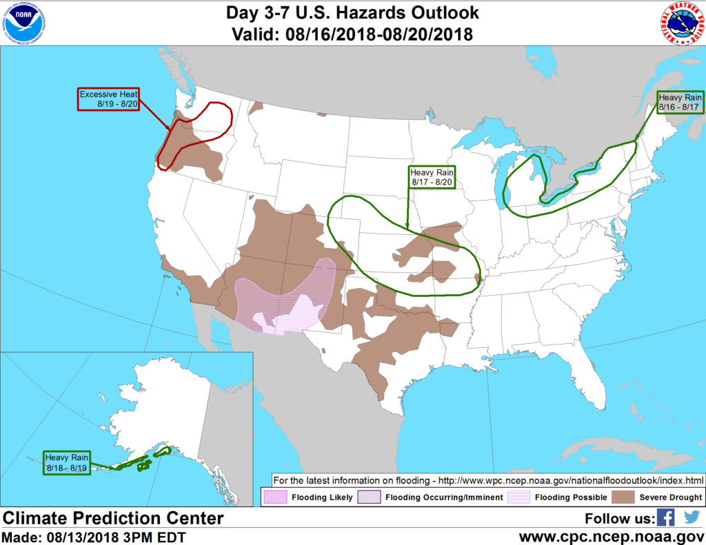 Looking ahead, the 6- to 10-day outlook calls for the likelihood of below-normal temperatures across the nation’s mid-section, while warmer-than-normal weather will prevail in the Far West, southern Texas, portions of the Atlantic Coast States, and the lower Great Lakes region. Meanwhile, near- to above-normal rainfall across most of the country should contrast with drier-than-normal conditions in the Pacific Northwest and southern sections of Texas and Florida.
Add Comment