Weather
A wet, active pattern across the Heartland
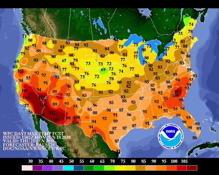 Cooler weather will prevail for the remainder of the week in several areas of the country. However, heat will linger for the next few days in much of the eastern U.S. and gradually return across the Far West. By week’s end, significantly above-normal temperatures should be mainly confined to the southwestern and south-central U.S.
 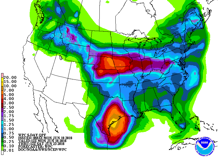 Meanwhile, heavy rain will affect numerous areas, including the western Gulf Coast region and a broad swath stretching from the northern Rockies into the Mid-Atlantic States. Five-day rainfall totals could reach 4 to 10 inches along and near the Texas coast and 2 to 4 inches in the western Corn Belt and environs. Dry weather will be mostly limited to California, the Southwest, and the upper Great Lakes region.
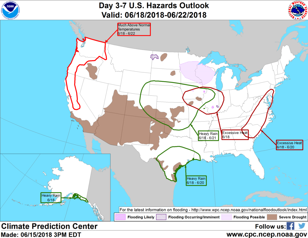 Looking ahead, the 6- to 10-day outlook calls for the likelihood of near- to above-normal temperatures and rainfall across most of the country. Cooler-than-norm al conditions will be limited to the central Plains, while drier-than-normal weather should be confined to northern New England, the upper Great Lakes region, and the Far West.
Add Comment