Weather
Early-season heat to cover much of the Heartland
 A tropical cyclone has formed near the Yucatan Peninsula. During the holiday week, potential U.S. tropical impacts may include heavy rain in Florida and the eastern Gulf Coast region, as well as tropical storm-force winds (39 mph or greater) and a coastal storm surge.
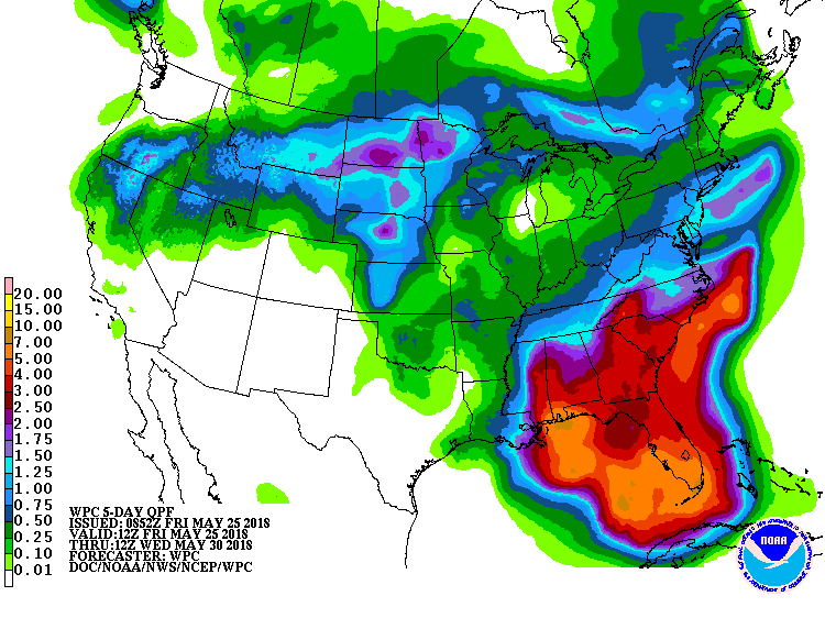 In the Southeast, 5-day rainfall totals could reach 2 to 8 inches or more. Meanwhile, generally dry weather from southern California to Texas should contrast with showery conditions from northern California and the northern Great Basin into the upper Great Lakes region. During the next several days, very warm weather will dominate the Plains and Midwest, while cooler-than-normal conditions can be expected to spread inland from the Pacific Coast and to develop along the Atlantic Seaboard.
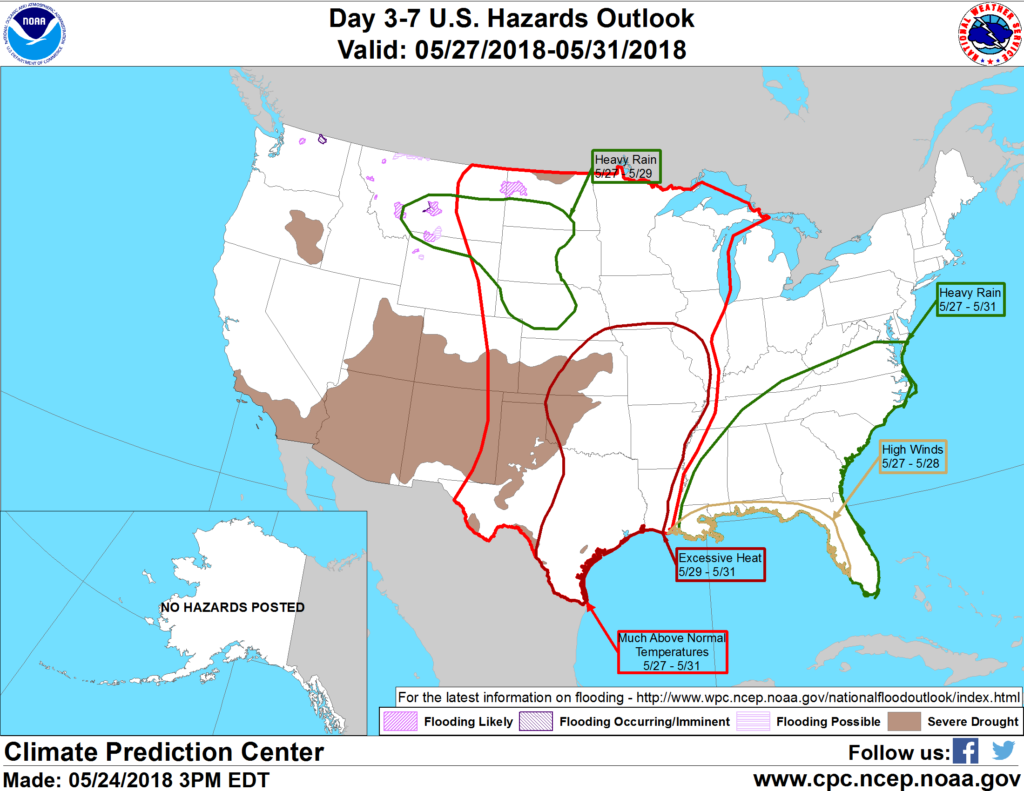 Looking ahead, the 6- to 10-day outlook calls for the likelihood of warmer-than-normal weather nationwide, except for near-normal temperatures along the Pacific Coast. Meanwhile, near- to above-normal rainfall across most of the country should contrast with drier-than-normal conditions in a few areas, including New England, the Pacific Northwest, and the south-central U.S.
Add Comment