Weather
Summer-like pattern across the Heartland
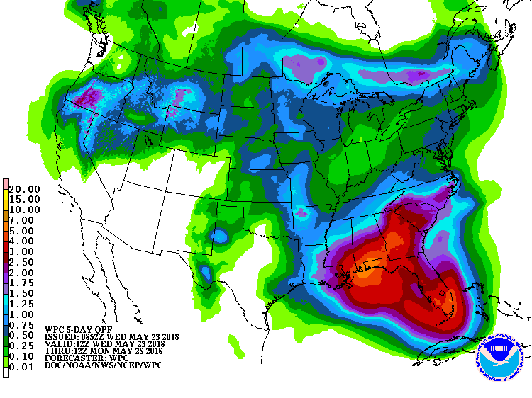 A low-pressure system over the western Caribbean Sea will drift northward, possibly acquiring tropical or subtropical characteristics. Regardless of development, an extremely wet weather pattern will persist in parts of the Southeast, where 5-day rainfall totals could reach 2 to 5 inches or more.
 Meanwhile, an array of disturbances will maintain showery conditions across the Plains and parts of the North, with some areas receiving as much as 1 to 2 inches during the next 5 days. In contrast, dry weather will prevail through week’s end in the Southwest. Elsewhere, above-normal temperatures will cover much of the nation for the remainder of the week; exceptions will include northern New England, the Far West, and the lower Southeast.
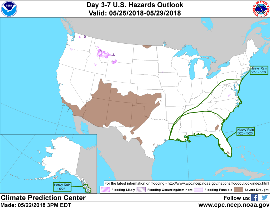 Looking ahead, the 6- to 10-day outlook calls for the likelihood of warmer-than-normal weather nationwide, except for near-normal temperatures in Florida. Meanwhile, near- to above-normal rainfall across most of the country should contrast with drier-than-normal conditions in a few areas, including Texas, New England, the upper Midwest, and the Pacific Northwest. Very wet weather may persist in the Southeast.
Add Comment