Weather
A warm-up ahead for the Heartland
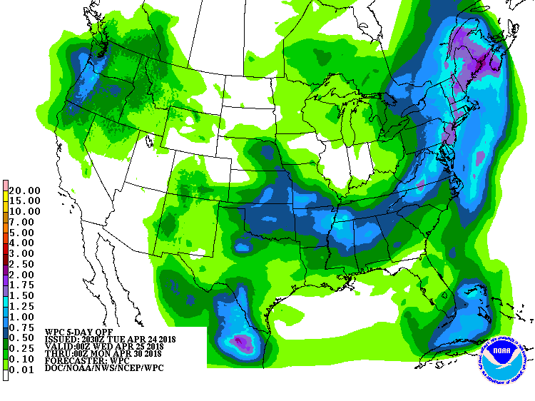 A slow-moving storm will drift northward along the Atlantic Seaboard, reaching New England on Thursday. Additional rainfall associated with the storm could reach 1 to 2 inches in the middle and northern Atlantic States. Meanwhile, a smaller disturbance will trail the initial storm, following a similar path across the Plains, South, and East, and delivering some additional showers. Toward week’s end, cool, showery weather will overspread the Northwest. Elsewhere, warm air will gradually shift eastward from the western U.S., encompassing much of the Plains and the Midwest by the weekend.
 Looking ahead, the 6- to 10-day outlook calls for the likelihood of above-normal temperatures across the Plains, Midwest, and Northeast, while cooler-than-normal conditions can be expected in the lower Southeast and much of the Far West. Meanwhile, near- to above-normal precipitation across most of the country should contrast with drier-than-normal weather in a few areas, including the eastern U.S. and the central and southern High Plains.
Add Comment