Weather
A pleasant change in weather ahead
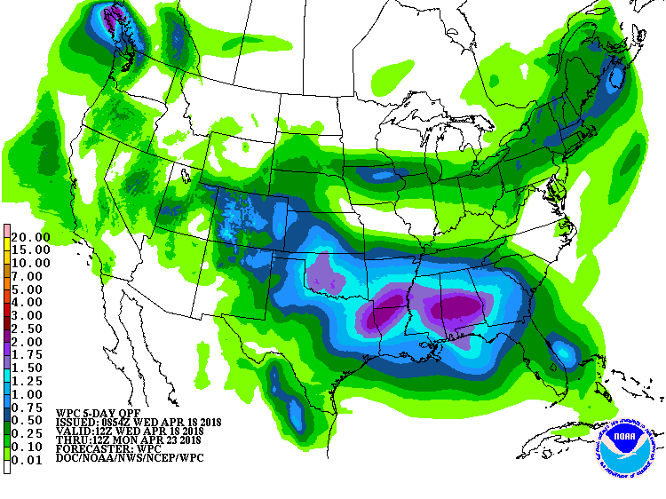 A storm system currently crossing the upper Midwest will move eastward, reaching the northern Atlantic Coast by late Thursday. A mix of rain and snow will accompany the system across the northern U.S. Meanwhile, a larger storm will cross the West and produce heavy snow in the central Rockies before reaching the Plains on Friday. Late-week precipitation totals across the nation’s mid-section will be variable, but some drought-stricken areas of the central and southern Plains could receive as much as 0.5 to 2.0 inches of rain. During the weekend, showers and thunderstorms will erupt across the mid-South and spread into the Southeast. By early next week, warm, dry weather will overspread much of the West.
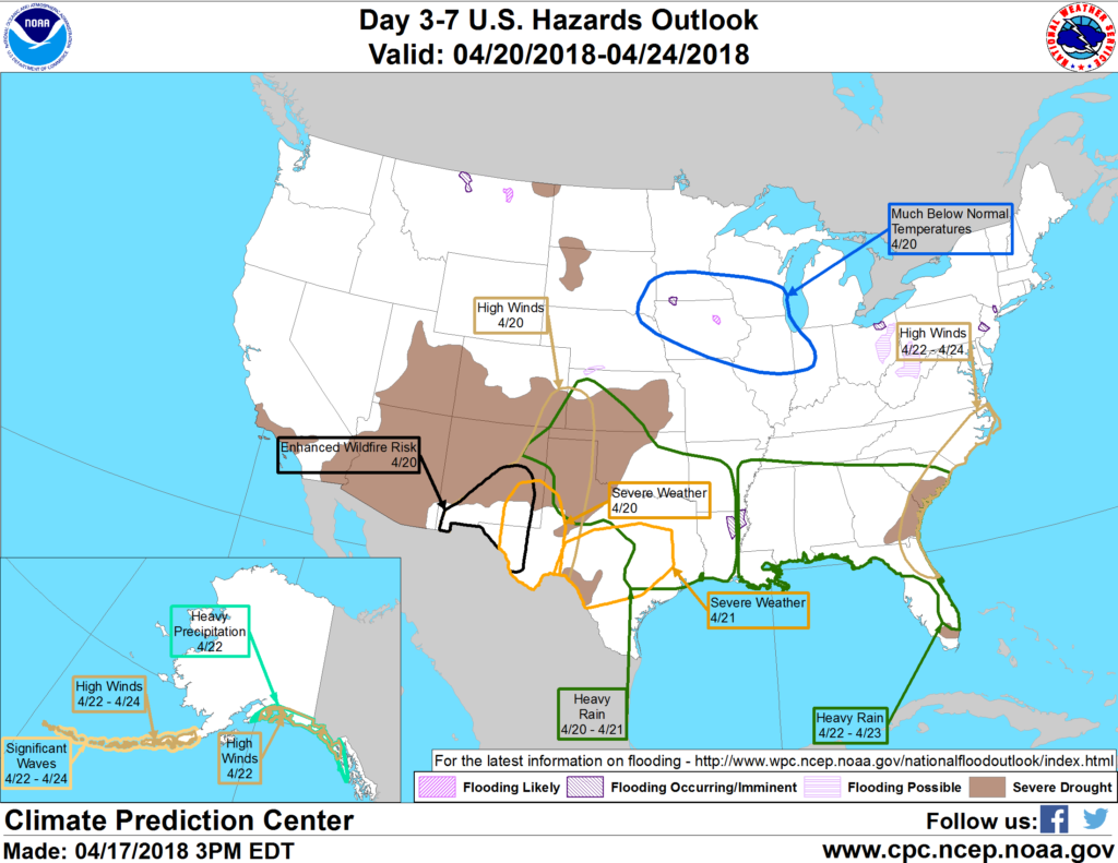 Looking ahead, the 6- to 10-day outlook calls for the likelihood of near- to below-normal temperatures across the eastern half of the U.S., while warmer-than-normal weather will cover the West. Meanwhile, near- to below-normal precipitation across the majority of the country should contrast with wetter-than-normal conditions in several areas, including the lower Southeast and central and southern sections of the Rockies and High Plains.
Add Comment