Weather
Active weather pattern underway
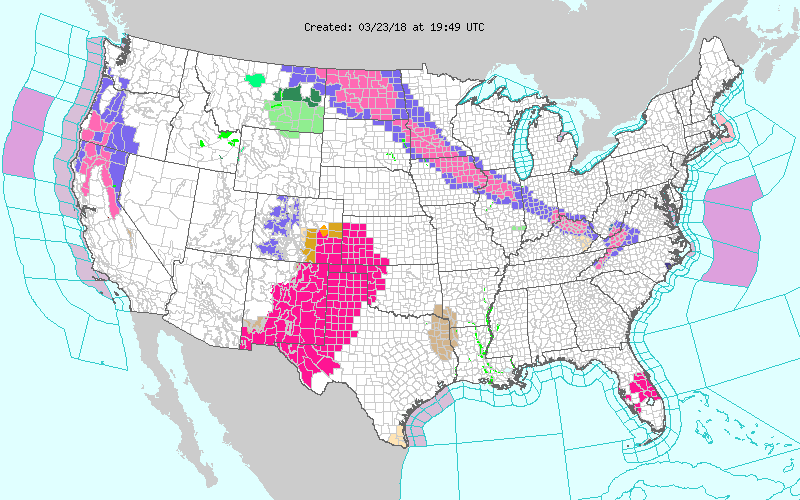 Across the Corn Belt, cool weather prevails in advance of an approaching storm system. Some light precipitation, mainly a mix of rain and snow, is overspreading the westernmost Corn Belt, including the Dakotas.
 On the Plains, precipitation—a mix of snow, freezing rain, and rain—is falling in parts of Montana and the Dakotas. In stark contrast, an early-season heatwave is underway across the central and southern High Plains, where Friday’s high temperatures could top 90° as far north as southwestern Kansas. The heat, accompanied by drought, high winds, and low humidity levels, is contributing to an extreme wildfire threat.
 In the South, Freezes were noted early Friday as far south as eastern Georgia and the Carolinas. Meanwhile, warm air is overspreading areas west of the Mississippi Delta. A few rain showers are occurring near the boundary between warm and cool air.
 In the West, dry weather has returned to California, but precipitation continues across the Intermountain West and Pacific Northwest. Late-season precipitation has been a boon to water-supply prospects, especially from the Sierra Nevada to the central Rockies.
Add Comment