Weather
Moisture-laden pattern; more cold ahead, too
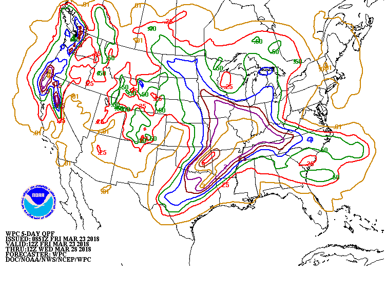 An early-season heatwave across the southern Plains will persist through the weekend but will end early next week. Farther north, accumulating snow will spread southeastward from the northern Plains, reaching parts of the central and southern Appalachians on Saturday. Early next week, a stronger storm system will emerge from the western U.S. and cross the Plains. Heavy rain (locally 2 to 6 inches or more) can be expected from the southeastern Plains into the middle Mississippi Valley, while some additional snow should fall in the north-central U.S. Elsewhere, cold, mostly dry weather will overspread the West, starting early next week.
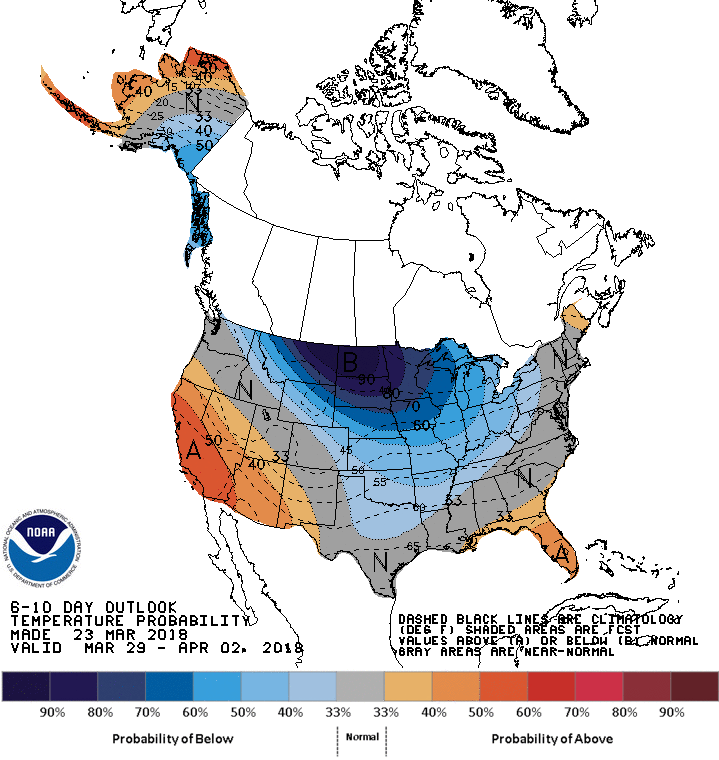 Looking ahead, the 6- to 10-day outlook calls for the likelihood of near- to below-normal temperatures and near- to above-normal precipitation across most of the country. Warmer-than-normal weather will be limited to California and the lower Southeast, while drier-than-normal conditions should be limited to Florida’s peninsula, northern and central California, and the Northwest.
Add Comment