Weather
Active pattern to continue
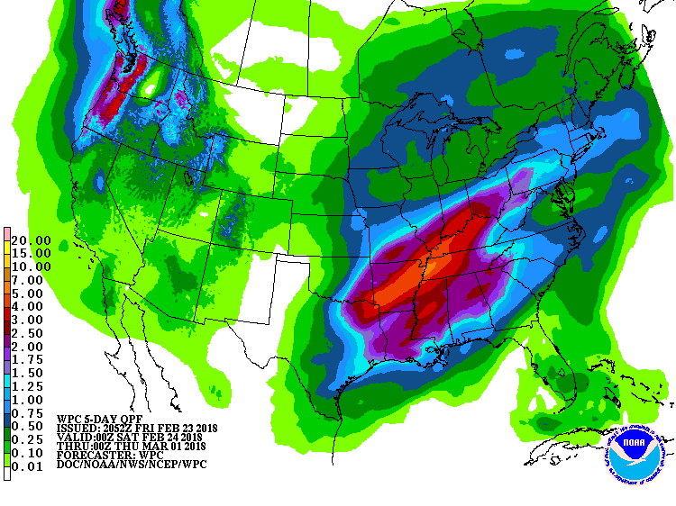 During the next few days, heavy rain will maintain an acute risk of flooding, or potentially worsen existing flooding, in the mid-South and lower Midwest. Five-day rainfall totals could total 2 to 5 inches from northeastern Texas into the Ohio Valley. As rainfall subsides late in the weekend, floodwaters will migrate from creeks and tributaries into main-stem rivers. Meanwhile, a snowstorm will unfold during the weekend from the central Plains into the upper Midwest. Farther west, snow will end across the Intermountain West but return to the Northwest. Elsewhere, little or no precipitation will fall across Florida’s peninsula and the southern High Plains.
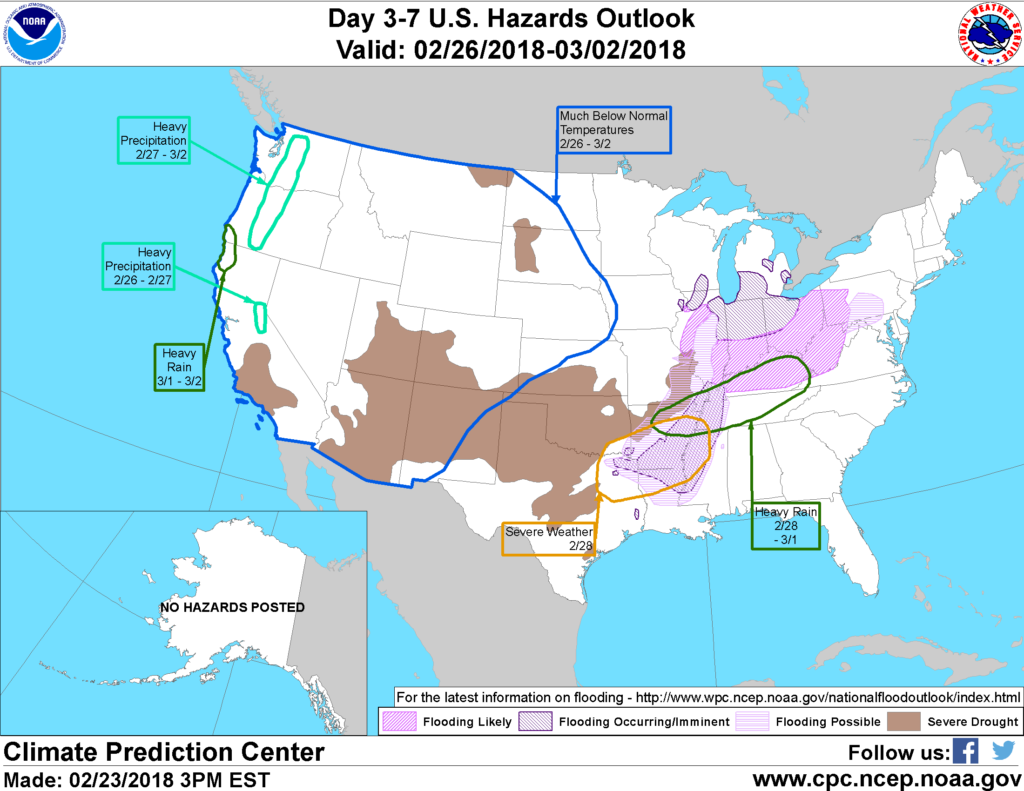 Looking ahead, the 6- to 10-day outlook calls for the likelihood of near- to below-normal temperatures across the eastern half of the U.S., while warmer-than-normal weather will prevail across the northern High Plains and the West. Meanwhile, near- to above-normal precipitation across most of the country should contrast with drier-than-normal conditions across Florida’s peninsula and from northern Minnesota to New England.
Add Comment