Weather
Temps to vary greatly across the Nation
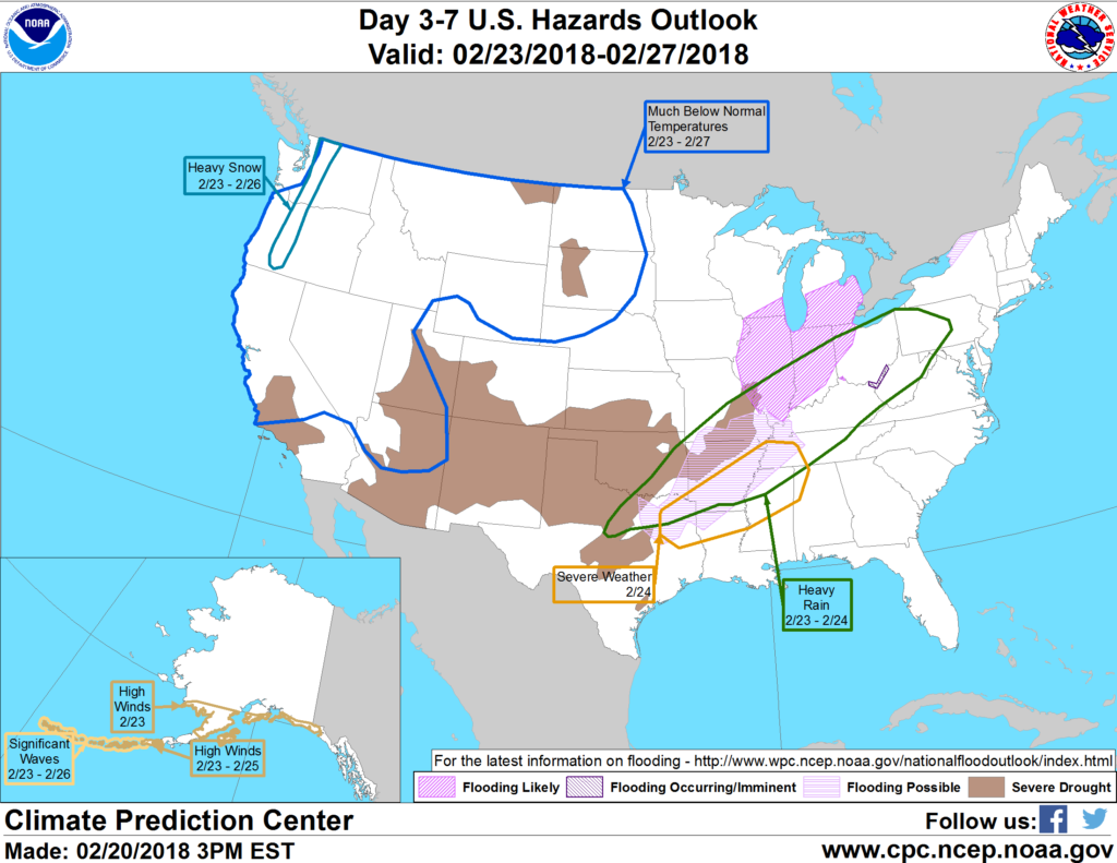
 A dramatic separation will continue between record-setting warmth in the East and unusually cold weather across the western and central U.S. The boundary between warm and cold air will remain the focus for significant precipitation during the next several days. As a result, flooding rains (locally 2 to 8 inches) can be expected from eastern Texas into the Ohio Valley. In addition, periods of freezing rain will occur from the southern Plains into the Midwest and Northeast. Toward week’s end, snow may develop across the upper Midwest and environs. In the West, occasional snow showers will accompany a continuation of cold weather. In contrast, mostly dry weather will prevail in Florida, as well as the northern and southern High Plains.
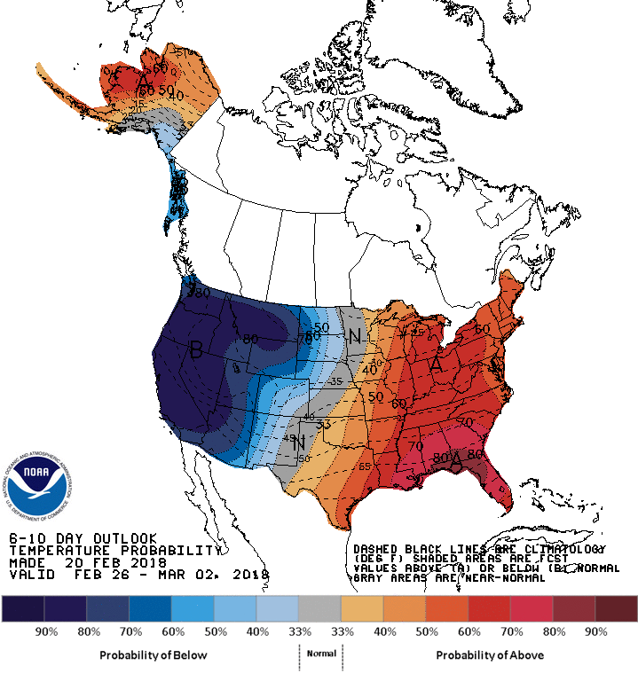
 Looking ahead, the 6- to 10-day outlook calls for the likelihood of below-normal temperatures across the northern High Plains and the West, while warmer-than-normal weather will cover the eastern half of the U.S. Meanwhile, near- to above-normal precipitation across most of the country should contrast with drier-than-normal conditions.
Add Comment