Weather
Late-Winter storm ahead early next week
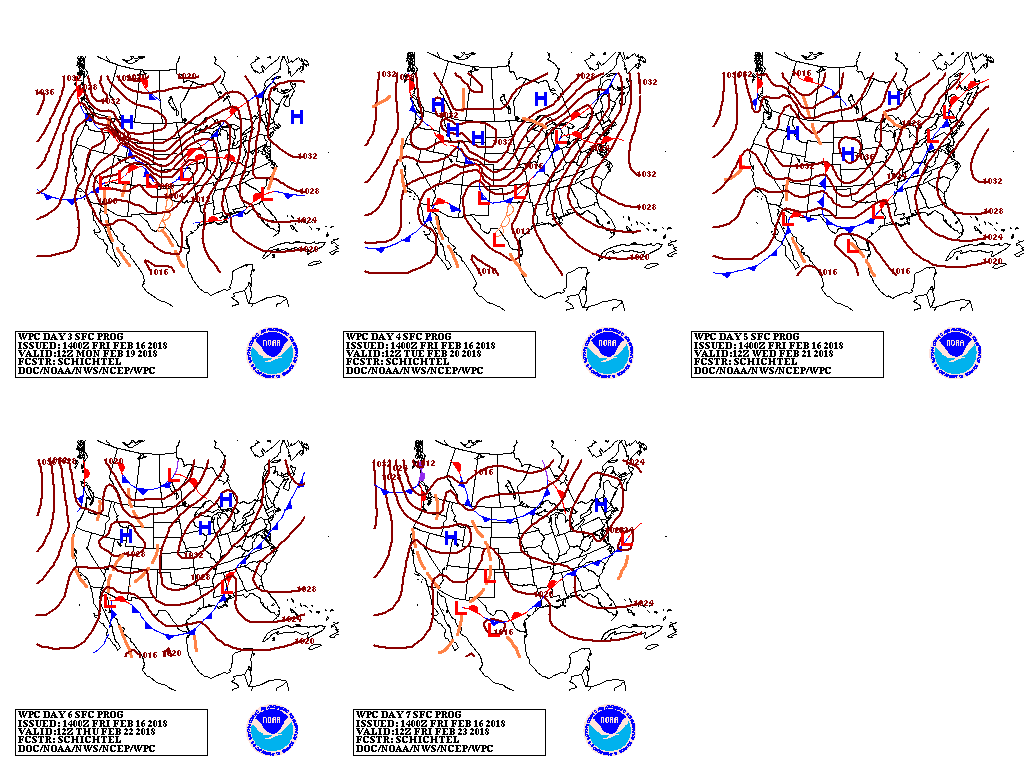 During the next 2 days, a fast-moving disturbance will race from northwestern Mexico to the Mid- Atlantic Coast, generating widespread, generally light precipitation. Parts of the Northeast will receive accumulating snow on Saturday night. Early next week, significant precipitation can be expected across the South, East, and lower Midwest. Five-day precipitation totals could reach 1 to 4 inches from eastern Texas into the lower Great Lakes region, the Ohio Valley, and the northern Mid-Atlantic States. In contrast, little or no rain will fall across the lower Southeast, the central High Plains, and central and southern California. Elsewhere, a surge of cold air will reach the Plains and much of the West early next week.
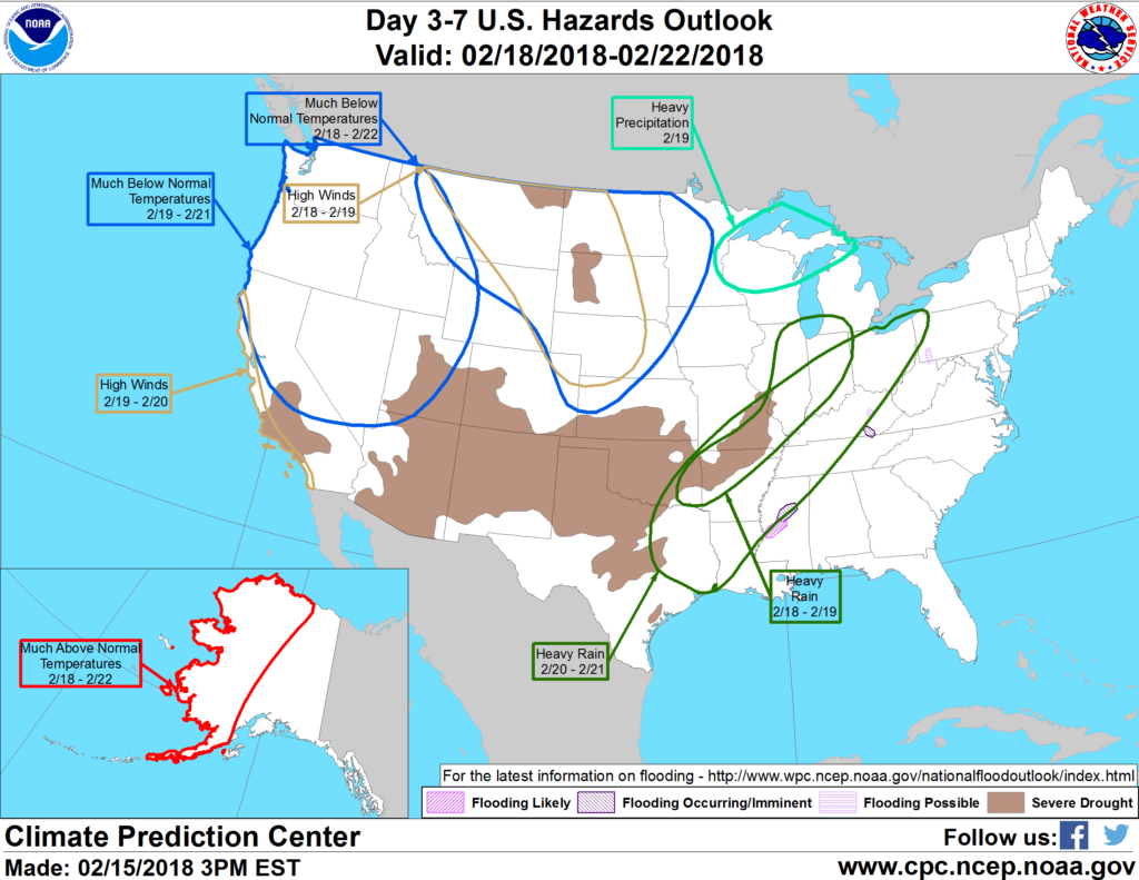 Looking ahead, the 6- to 10-day outlook calls for the likelihood of below-normal temperatures across the northern Plains and much of the West, while warmer-than-normal weather will prevail along and east of a line from Texas to Michigan. Meanwhile, near to above-normal precipitation across most of the country should contrast with drier-than-normal conditions in California, the southern Rockies, and the lower Southeast.
Add Comment