Monterey Bay is a world famous vacation destination. There are around 200 hotels and B&Bs within ten miles of Monterey. Landscapes, seascapes, marine mammals and pine forest are outdoors attractions.
Regularly I take a walk, snap some photos and show what a typical day by the Bay can mean in terms of seeing wildlife in this area and I piece together a little more knowledge of the local environment. I had the good fortune to be born here beside Monterey Bay, although I am still five years shy of having spent half my life here.
Yesterday was one of my walk and shoot days along the coastal trail of Pacific Grove, California (population 15,407 in 2012).
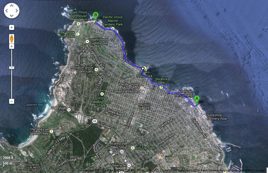
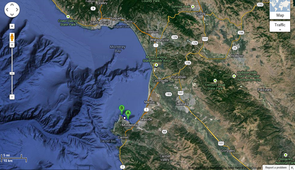
Google Satellite Map of Pacific Grove from Monterey Bay Aquarium (pin A) at to Point Pinos (pin B) on the northwestern tip of the Monterey Peninsula. Monterey is the area from A pin at the aquarium to south.
The second rain shower of the rainy season over Monterey Bay last week followed by cold air was one reason to get outside and walk the coastal trail of Pacific Grove. Air pollution obscuring long distance views is not an issue here. The wind generally blows from the Pacific Ocean over Monterey Bay. The sea air moisture and fog typically obscures the view across Monterey Bay most days of the year.
The past few days and nights clear, cold air has dropped temperature to the mid-forties with brilliantly vivid daytime views. The temperature rose from 46F to 60F between 7:30am and 10:30am yesterday when I walked the coastal trail of Pacific Grove.

Harbor seals bask in the sun on most of these rocks at Pacific Grove.
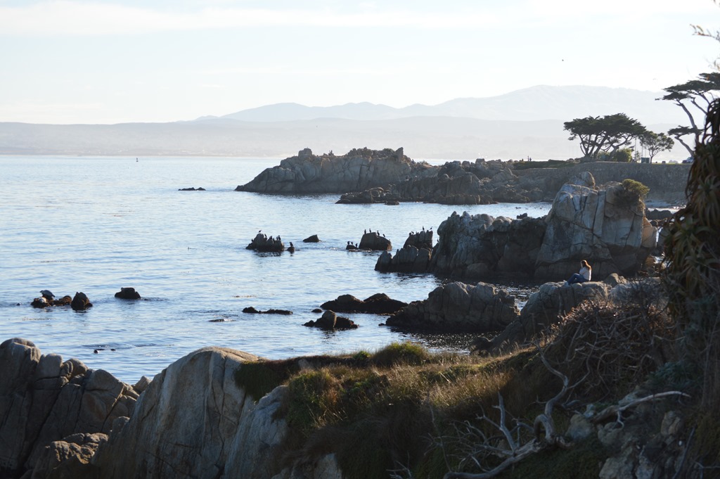
Fremont Peak at 3,169 feet seen in the distance of the photo above is about 30 miles away. The peak is named for John C. Fremont who raised the American flag in March 1846 at a time when this area still belonged to Mexico and Monterey was the capital of Alta Mexico. Four months later, at the start of the Mexican-American War, the US Navy raised the United States flag at the Custom House in Monterey in a bloodless turnover of the Mexican capital to the Americans. Two years later in 1848 California officially became territory of the USA.
Fremont Peak is a popular astronomy location due to the Monterey Bay fog blocking the electric light emanating from the ground around residential areas of the Salinas Valley and Monterey Bay communities. Fremont Peak sits above the fog layer in a rural mountain location, far from other light sources.

Nine harbor seals on the rocks and one more seal in the water at top.
The walk along the coastal paths of Monterey and Pacific Grove is one of the best places to observe marine mammals from the shore. Ocean life is one of the primary attractions to the Monterey Peninsula. Whale watching cruises are a year round business in these parts. The gray whale migration in December and January to Baja California usually means whale sightings from the coastline are possible on days when the ocean is calm.
In the 1990s I spent a couple months walking the coast of Ireland during two summers. I saw two seals in two months. I lived on the coast of Maine for two years. From our oceanfront rental I only saw one or two seals a couple times in the waters of Maine.
Yesterday, in two hours, I saw about 70 harbor seals, dozens of sea lions floating in the bay with their flippers extended out of the water in the sunlight and around 15 sea otters, more southern sea otters than I have seen on any day in 2013 from the Monterey-Pacific Grove coastal trail.

Black & White Harbor Seals.
My camera eye tends to focus on the ocean view when walking the coastal path along Monterey and Pacific Grove. The land view of the Central Coast is unique for California. Most Californians who live in Southern California do not associate the coast with forest lands. In northern California, north of San Francisco, coast redwoods dominate the forest lands. The Monterey pine forest setting makes the Monterey Peninsula a place where trees reach the sea.
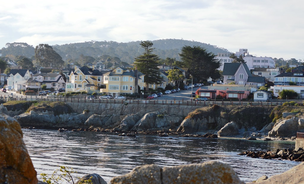
Seven Gables Inn B&B, Pacific Grove is the large yellow house across the street from the sea. Room rates range from $219 to $419.
The photo above was shooting into the morning sun from Lover’s Point rocks in an attempt to show the forested ridges of the Monterey Peninsula hills. Here is a better view of Seven Gables Inn from the coastal path.
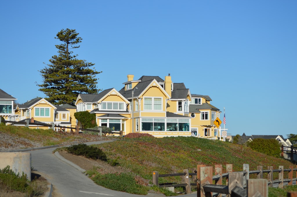
Seven Gables Inn, Pacific Grove.
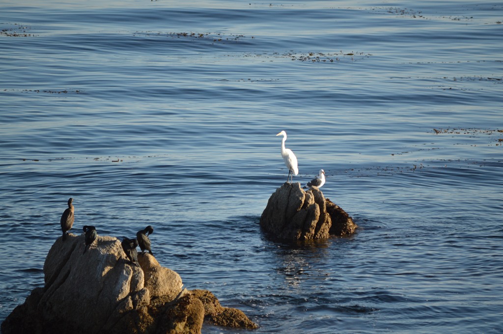
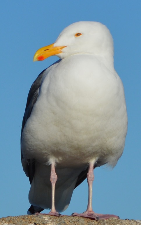
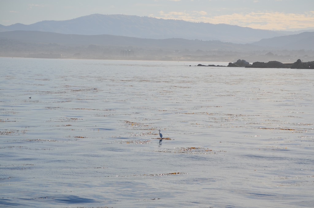
Birds are another aspect of life on the coast. Great egrets sitting tall offshore, floating on thick beds of kelp are a year-round sighting. Yesterday I saw several great egrets sitting on the kelp of Monterey Bay and one great egret on a rock near shore.
Black & White sea birds.
The black Brandt’s cormorants on the rocks are common sea birds. Seagulls are fairly large birds, yet the seagull beside the Great Egret looks small. Great egrets are typically about 3 feet tall with a wing span around 5 feet.
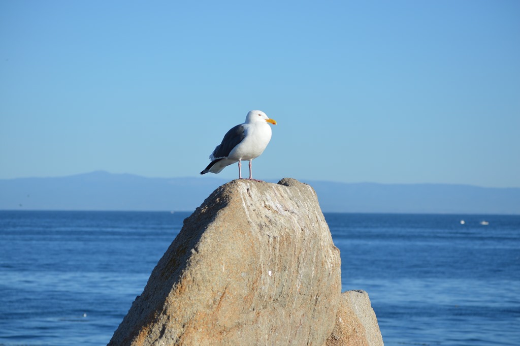
On Lover’s Point, I was the only person hiking the rocks for 15 minutes where one brave seagull held his position on top of the top rock.
Seagull standing above the spray.
There are three mountain landmarks seen from the southern side of Monterey Bay in Pacific Grove. Fremont Peak to the northeast is seen in the first photo of this post.
Great egret sitting on kelp bed in Monterey Bay. Mount Toro backdrop.
Mount Toro at 3,560 feet is east of Monterey. The Salinas Valley is on the other side. This photo is taken at Lover’s Point, Pacific Grove. Nobel Prize novelist John Steinbeck of Salinas referred to Mount Toro as the ‘pastures of heaven’. These days a close up view of the valleys leading to Mount Toro reveal much of the landscape to be the pastures of private estates.
Loma Prieta, 3,790 feet is the highest peak in the Santa Cruz Mountains north of Monterey-Pacific Grove, seen to the left behind the seagull at Lover’s Point. This was the epicenter of the 1989 Loma Prieta earthquake of San Francisco-Oakland.
Pacific Grove is the most laid back community on the Monterey Peninsula. PG, as locals call the town, is a great place to chill out beside the Pacific Ocean.
To walk the path where these photos were taken is simply a matter of walking west from the Monterey Bay Aquarium along the coastline of Pacific Grove. The aquarium is the western-most building of Cannery Row in the city of Monterey. Point Pinos is the western point of Pacific Grove and about 2.5 miles west of the aquarium walking along the coastline.
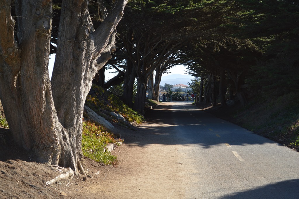
Bicycle path on Monterey Bay Recreation Trail. Dirt paths allow closer access to ocean views along some of the rocky outcrops. Benches are frequently spaced.
Pacific Grove is a great seaside town to find a secluded place on the rocks and take in the world through all your senses.
Bring binoculars to see marine life and sea birds up close.

Pelicans over Point Pinos, Pacific Grove (Nov 8).
Monterey Bay is a scallop-shaped bay on central coast of California located 70 miles south of San Francisco. Monterey is 110 miles from San Francisco.
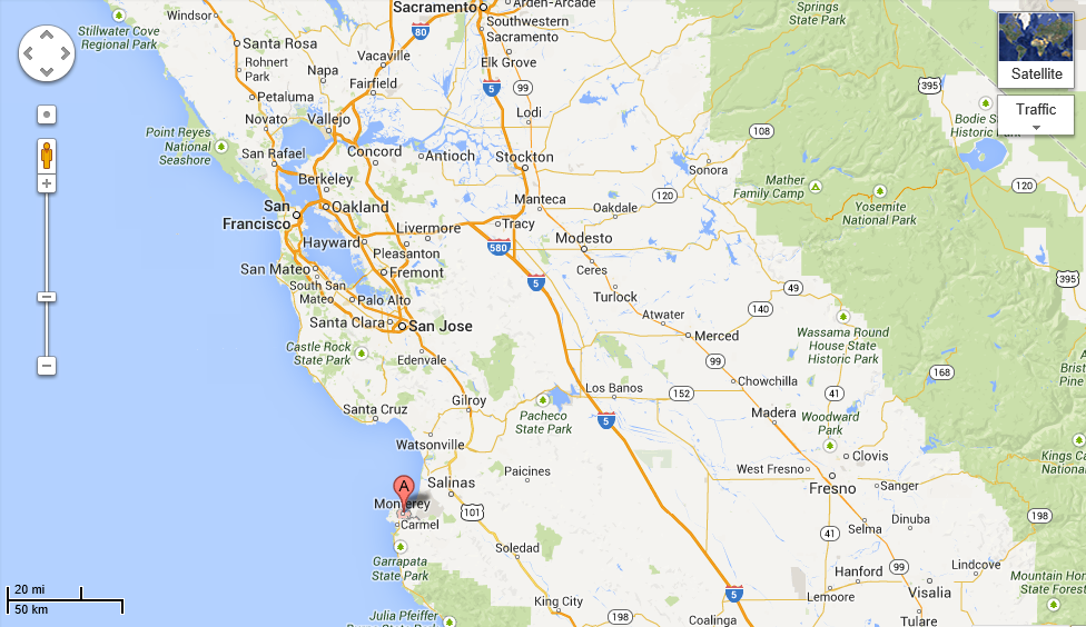
Google Maps – Monterey Bay and San Francisco Bay.
*****
Ric Garrido of Monterey, California is writer and owner of Loyalty Traveler.
Loyalty Traveler shares news and views on hotels, hotel loyalty programs and vacation destinations for frequent guests.
Follow Loyalty Traveler on Twitter and Facebook and RSS feed or subscribe to a daily email newsletter of Loyalty Traveler blog posts.

3 Comments
Comments are closed.