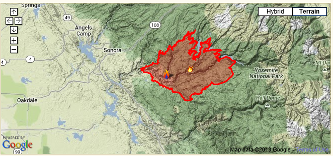
The ‘Rim Fire’ burning around Yosemite National Park since August 17 today became the 7th largest wildfire in California in the past 100 years as the burn total surpassed 180,000 acres.
The burn area of the Rim fire displaced the 1977 Marble Cone fire in the Big Sur area of Monterey County as #7 biggest wildfire in the state. When I was a teenager working with the U.S. Forest Service, Marble Cone was considered the largest forest fire in in modern California history. Interestingly, five of the six larger California wildfires happened in the past ten years.
I have traveled through Yosemite National Park three times in the past two years. Most recently in May 2013.
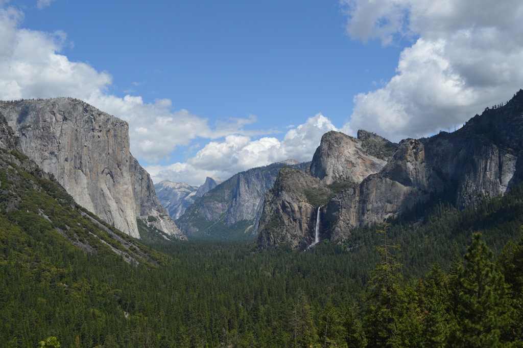
Tunnel View of Yosemite Valley is the classic photo spot named for the Wawona tunnel road in the mountain where cars come out of the Highway 41 tunnel into the light with this view. Bridalveil Fall (620 ft.) on right side of valley.
Fortunately the Rim Fire is not near this section of Yosemite National Park.
Highway 120, the Tioga Pass Road that crosses the Sierra range through Yosemite is currently closed in the western approach to Yosemite National Park.
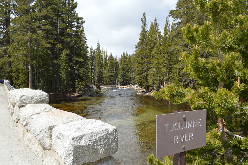
Tuolumne River at Tuolumne Meadows in the high Sierra near the eastern side of Yosemite National Park.
Smaller fires have burned areas of Yosemite in recent years.
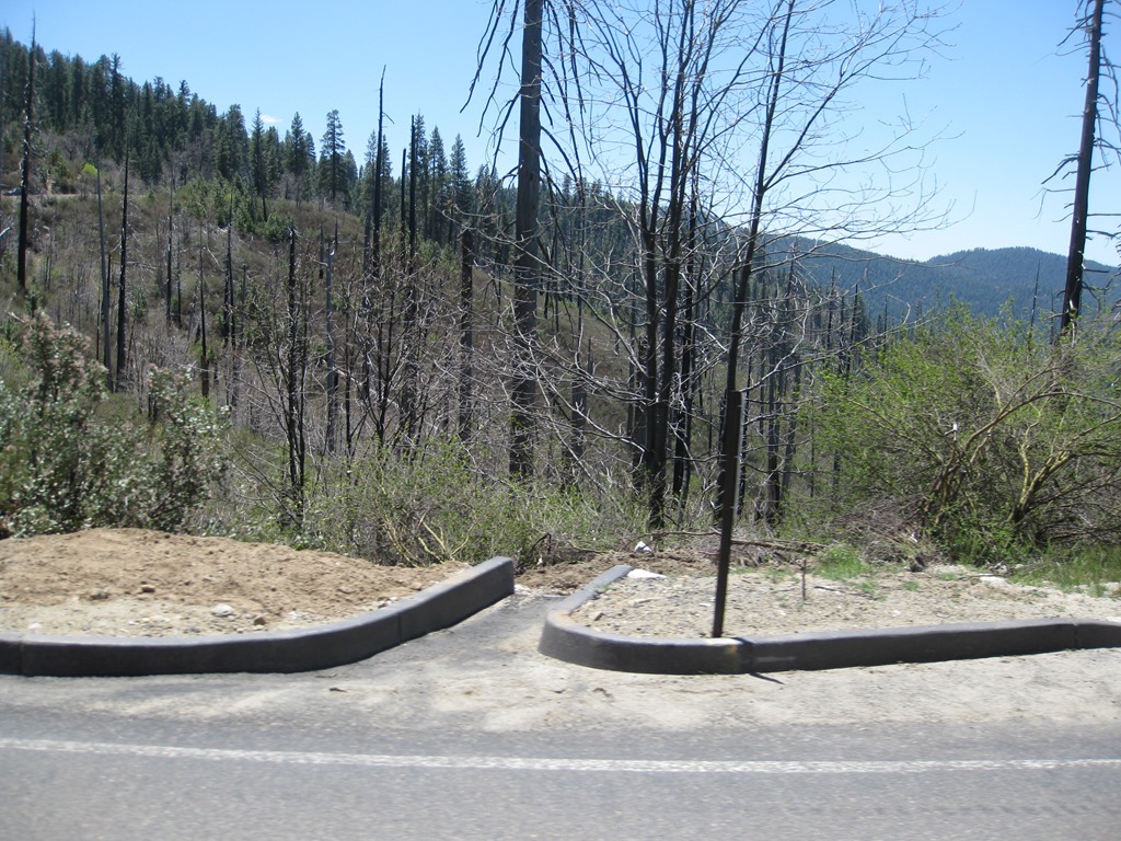
Highway 120 view near Crane Flat within Yosemite National Park (May 2013).
Highway 41 view in Yosemite National Park (May 2011)
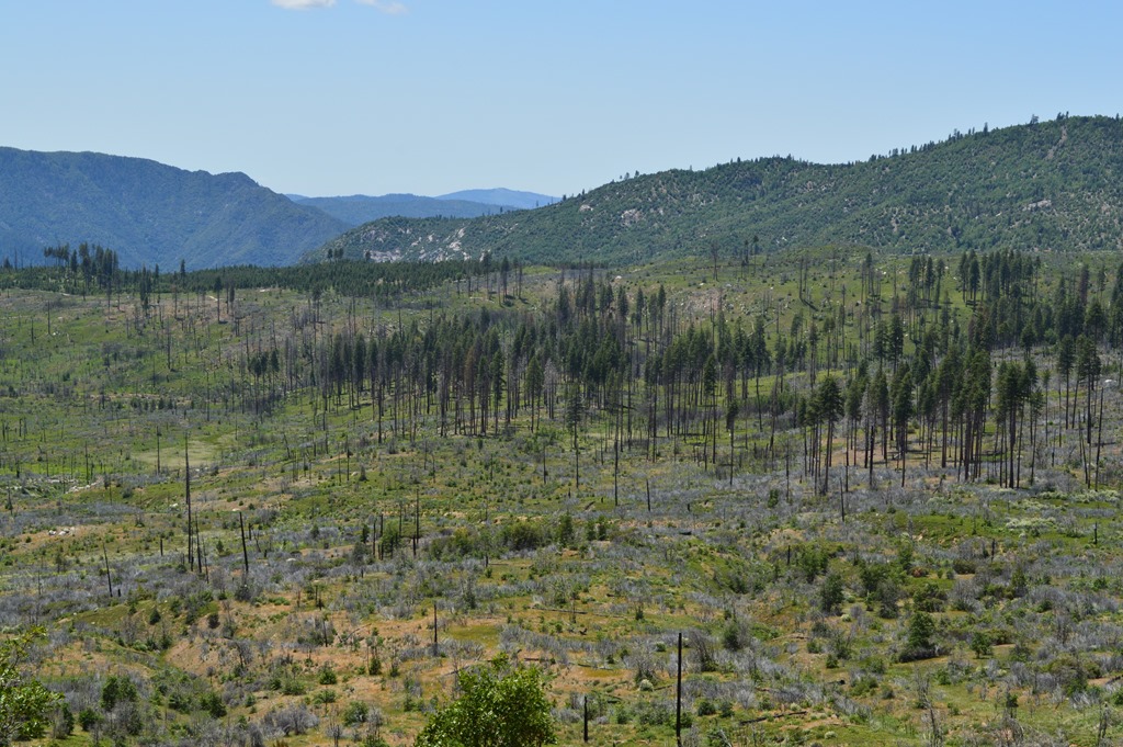
Driving Highway 120 or Highway 41 into Yosemite National Park means about an hour driving through forests to reach Yosemite Valley. This is rugged, rocky terrain covered mostly in ponderosa pine and fir forest.
Much of the Stanislaus forest was logged in the 19th century. In 1897 the Stanislaus National Forest was created encompassing nearly 900,000 acres of timberland in four California counties. Total forestland in Stanislaus is about 680,000 acres and around 20% of that forest is considered old growth forestland.
The creation of two National Parks south of Yosemite with Kings Canyon and Sequoia National Parks was in large part to halt the logging of the largest trees on Earth, Sequoiadendron giganteum, the Giant Sequoia. Sequoia National Park was created in 1890 as the nation’s second national park.
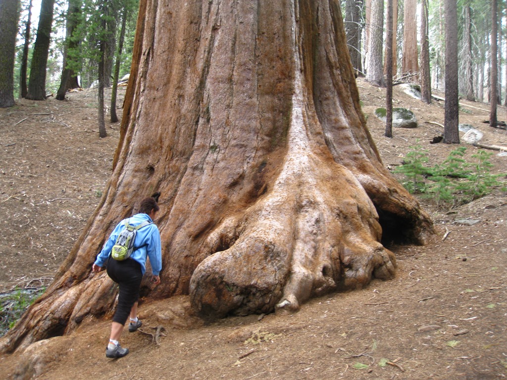
Giant Sequoia at Kings Canyon National Park.
Firefighters have set up sprinklers to douse Giant Sequoia trees in the Merced and Tuolumne Groves, two of three Giant Sequoia groves around Yosemite National Park threatened by the Rim fire.
There are about 75 Giant Sequoia groves remaining in a 200-mile stretch of the Sierra Nevada range, mostly at 5,000 to 7,000 feet in elevation.
In the 19th century these giant trees were logged and the wood was used for everyday items like fruit orchard stakes and pencils. Somewhat of a waste of natural resources for trees that had lived for 2,000 years.
God has cared for these trees, saved them from drought, disease, avalanches, and a thousand tempests and floods. But he cannot save them from fools. – John Muir

Many Giant Sequoia redwoods show signs of previous fires.
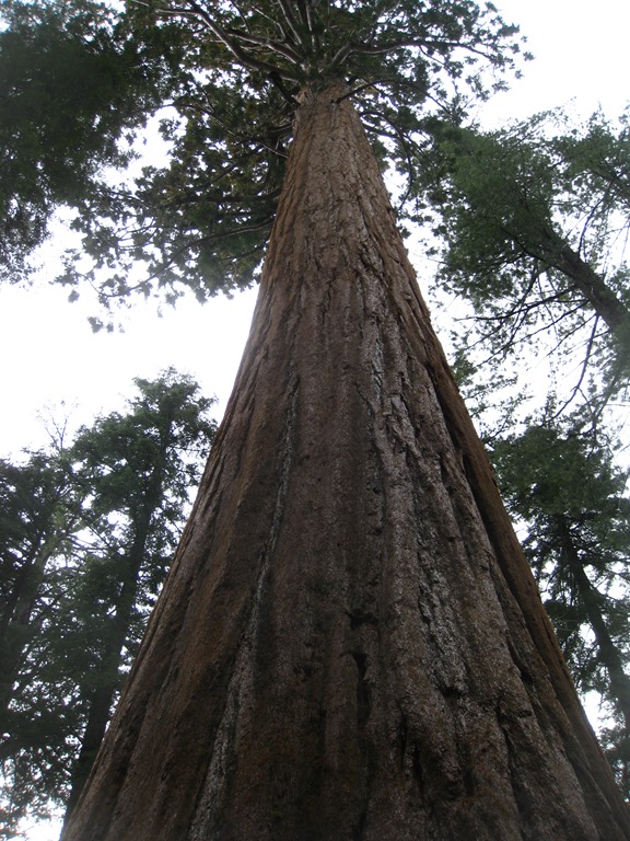
Land of the giants.
Giant Sequoias
Massive, ancient giant sequoias live in three groves in Yosemite National Park. The most easily accessible of these (spring through fall) is the Mariposa Grove near the park’s South Entrance, off of the Wawona Road (Highway 41). Two smaller—and less visited—groves are the Tuolumne and Merced Groves near Crane Flat.
The Mariposa Grove Road is closed to cars approximately November to April, depending on conditions. You can hike up the two-mile road (500 feet of elevation gain) when it is closed (the road may be snowy or icy). Sequoias are visible from the parking lot and a tram tour is available from approximately May to October. (Learn more about the Mariposa Grove…)
No roads enter the Tuolumne or Merced Groves; two to three miles of hiking (about 500 feet of elevation gain) is required before you will see giant sequoias.
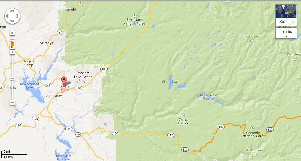
Highway 108 is the road I was planning to drive in a couple of weeks as I traveled to Calaveras County and looped through the Sierra via Highway 4 and 108. Residents living around Highway 108 are now being evacuated due to the Rim fire with a center set up at the Mother Lode Fairgrounds in Sonora.
The fire has reached the shore of Hetch Hetchy Reservoir, the water supply for San Francisco.
http://inciweb.nwcg.gov/incident/3660 (August 27, 2013)
Yosemite National Park website has a special page dedicated to Rim Fire updates.
Fire is nature’s way of renewal. Yellowstone National Park had a fire 25 years ago that burned one million acres.
Hopefully California will see the firefighters contain the Rim fire without too much more destruction of the old growth forests.
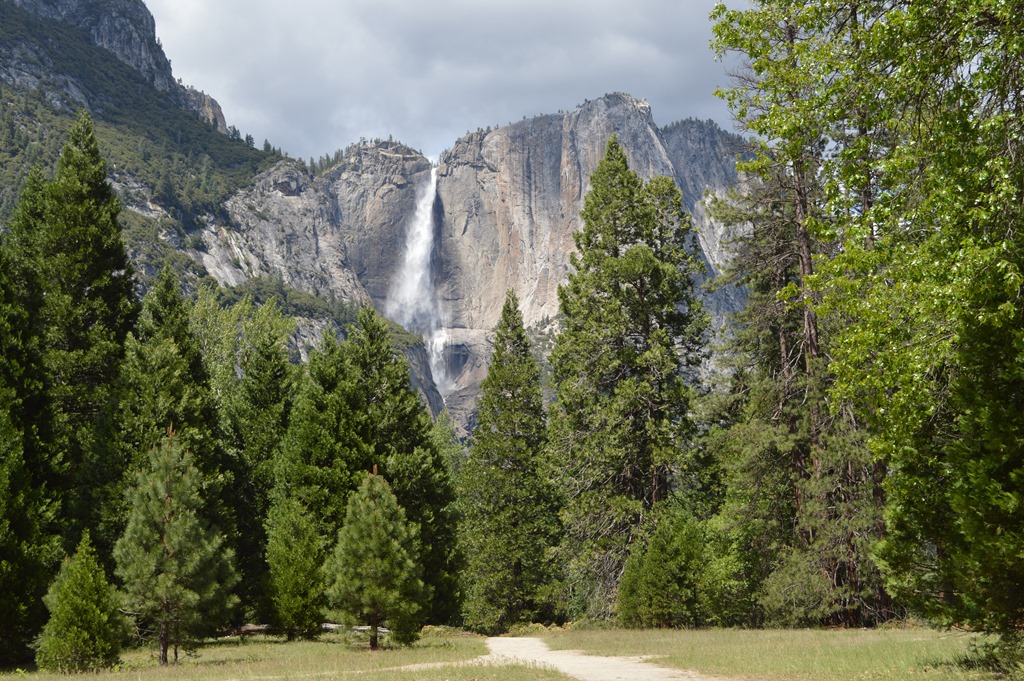
Yosemite Falls in Yosemite Valley.

Forestland off Highway 120 in Yosemite National Park.
Related Loyalty Traveler Posts:
The Mountains are Calling and I Must Go (Kings Canyon National Park) – May 15, 2011.
Yosemite lodging south entrance Highway 41 from Fresno – photos and hotel lodging options between Fresno and Yosemite Valley (5-16-2011).
Yosemite Valley – photos of Yosemite waterfalls May 2011 and hotel/cabin tent lodging options in Yosemite Valley (5-17-11).
Yosemite’s Tioga Road across the Sierra Nevada (July 13, 2011).
Yosemite Valley Waterfalls (May 19, 2013)
Tioga Pass Road Yosemite National Park (May 19, 2013)
Ric Garrido, writer and owner of Loyalty Traveler, shares news and views on hotels, hotel loyalty programs and vacation destinations for frequent guests.
Follow Loyalty Traveler on Twitter and Facebook and RSS feed or subscribe to a daily email newsletter on the upper left side of this page.

9 Comments
Comments are closed.