Utah Scenic Byway 12 is a 124 mile road that traverses one of the last areas of the lower 48 states to be explored, mapped and given place names during the second Powell expedition of the Southwest in 1872.
Scenic Byways gives a 3-day itinerary for this 124-mile stretch of road. I made the drive in one day with about 5 hours in Bryce Canyon National Park and numerous photo stops.
Utah Scenic Byway 12 is like a Disney Cars Land ride for adults who want control of the wheel and car speed. This route is popular with motorcyclists.
Here are some views along the way.

Red Canyon tunnel.
Utah Highway 12 is the road to reach Bryce Canyon National Park via Highway 63. Bryce Canyon city is 13 miles from the western end of Scenic Byway 12.
I stayed at the Best Western Ruby’s Inn at Bryce Canyon City for 16,000 points. The room rates were about $125. There is also a newer Best Western Bryce Canyon Grand Hotel across the street and the room rates there were about $165. Ruby’s Inn has the indoor pool and restaurants. Bryce Canyon Grand Hotel has an outdoor pool and free breakfast.
Both are fine hotels in a place with few lodging options.
Highway 63 is 20-mile dead-end road through Bryce Canyon National Park. The National Park visitor center is a mile past the hotels and gas stations in Bryce Canyon City.
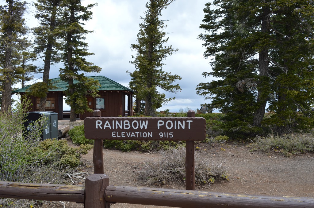
Rainbow Point parking lot is the terminus of Highway 63 in Bryce Canyon National Park. Driving Highway 63 is mostly at 8,000 to 9,000 feet in elevation.
Bryce Canyon is a narrow plateau. From Rainbow Point there are hiking trails to the end of the plateau.
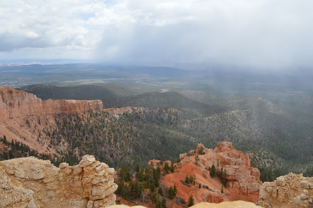
View from Bristlecone Pine Loop trail from Rainbow Point, Bryce Canyon National Park.
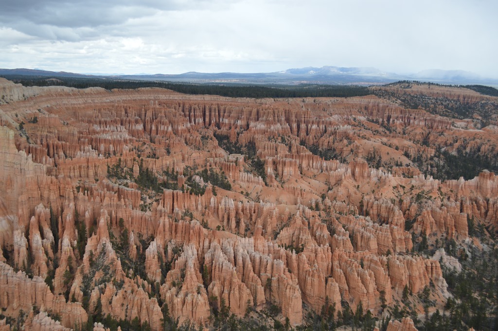
Bryce Point view of hoodoos.
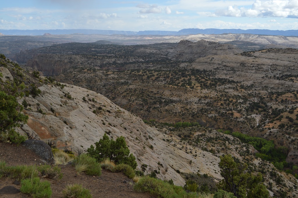
From Bryce Canyon National Park the road east on Scenic Byway 12 goes through several different landscapes.
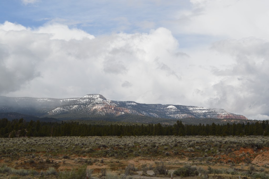
Dixie National Forest.
Grand Staircase-Escalante National Monument is considered one of the most remote areas of the lower 48 states. It is the largest of the U.S. National Monuments and larger than the state of Delaware.
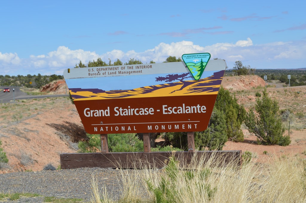
Grand Staircase-Escalante National Monument
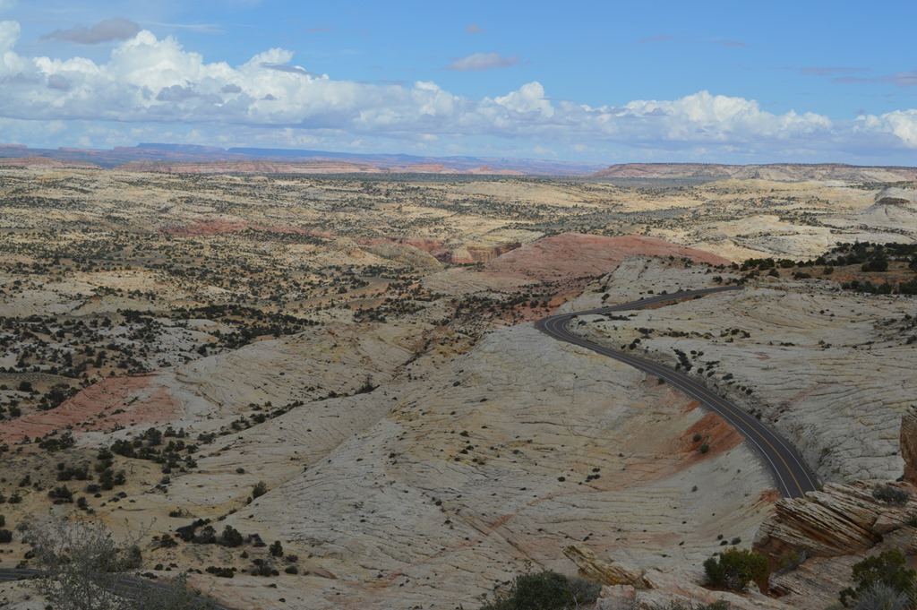
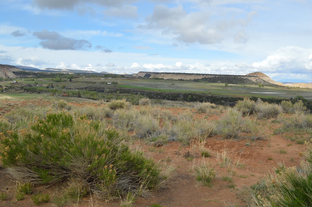
Escalante River Basin
The Escalante River is named for a Franciscan missionary who was the first European to explore the area in 1776 in an expedition to find a route from Sante Fe, New Mexico to Monterey, California.
It was the last river of its size to be discovered in the 48 contiguous U.S. states.[1] The average discharge is approximately 146 cfs.
The river was first mapped and named by Almon Thompson, a member of the 1872 Colorado River expedition led by John Wesley Powell.[1] It was named after Silvestre Vélez de Escalante, a Franciscan missionary and the first known European explorer of the region. In 1776, Escalante and his Spanish superior Francisco Atanasio Domínguez left from Santa Fe, New Mexico on an attempt to reach Monterey, California.[2] During this journey, usually referred to as the Dominguez-Escalante Expedition, Escalante and his companions passed by the Grand Canyon and were the first white men to enter Utah.
Much of the Escalante River’s course is through sinuous sandstone gorges. The river and the rugged canyons which drain into it form a key section of Grand Staircase-Escalante National Monument. This spectacular region is a popular destination for hiking and backpacking.
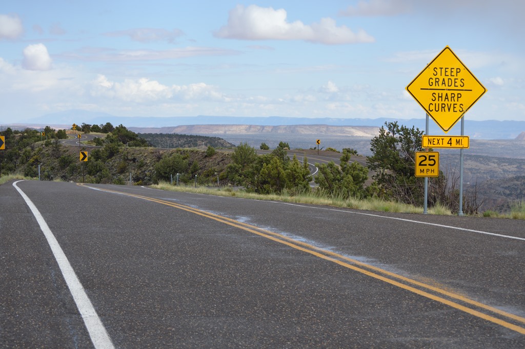
The road was taking me into some dark clouds and water streaming on the road was evidence of recent heavy rain. This is a road where 40 miles an hour is a good average speed.
View west of Boulder, Utah.
This narrow strip of land called Hell’s Backbone is only about 50 feet wide in places with thousand foot drops on both sides. There is a gravel road near here built in the 1930s that is the actual Hell’s Backbone.
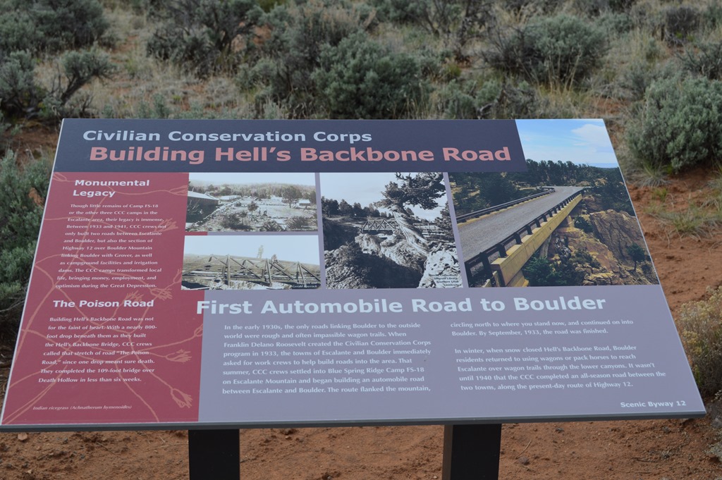
Hell’s Backbone was the first road built between the towns of Escalante and Boulder, Utah. Scenic Byway 12 is 24 miles to connect the towns and that paved road was completed in 1940. Prior to the roads the trip took three days by wagon.

Photograph at Boulder scenic turnout on Highway 12 showing mule train crossing Escalante Basin.
The town of Boulder is so remote that electricity did not arrive in the town until 1947.
At 9,000+ ft. on Route 12 with Aspen forest. The clouds parted to allow a gorgeous view from Boulder Mountain.
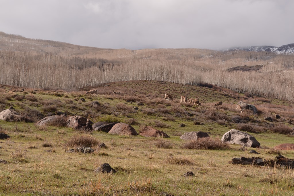
Deer grazing on Boulder Mountain.

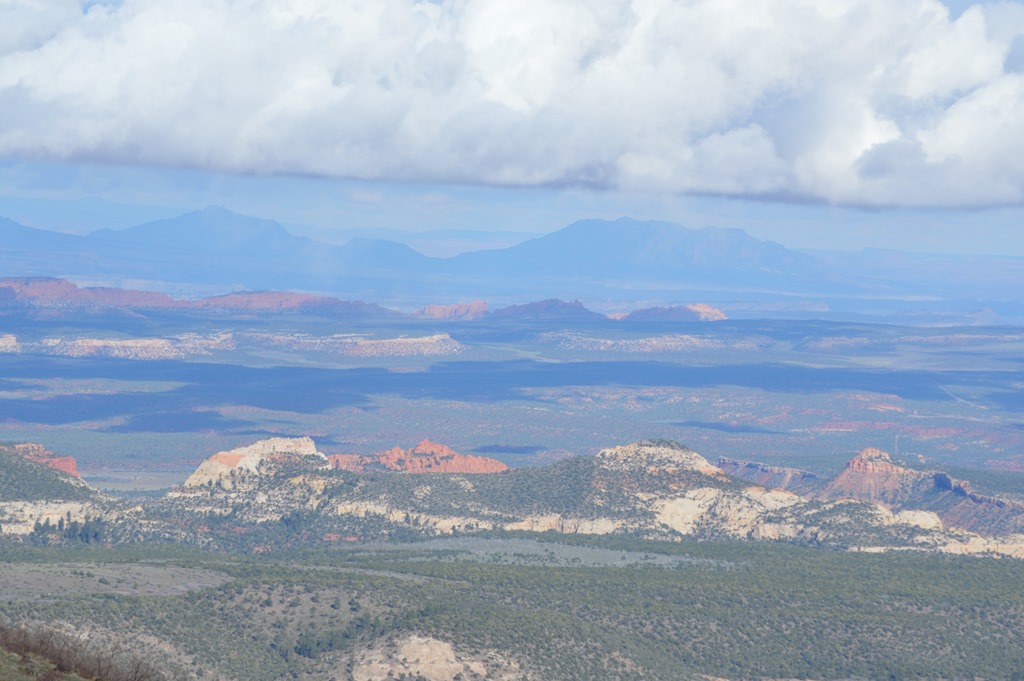
Homestead Overlook view of Escalante basin.
View from Boulder Mountain looking east to the Henry Mountains. The Henry Mountains were the last mountains in the lower 48 states to be named.

Scenic Byway 12 summit at 9,600 ft on Boulder Mountain.
The weather finally caught up with me and I hit snow and ice just past the summit on the descent to Torrey, Utah – gateway to Capitol Reef National Park.

There were so few cars on Scenic Byway 12 between Escalante and Torrey that I started calculating in my head. I estimate there were about 30 vehicles traveling in each direction per hour between 4 and 6 pm on a Wednesday.
If Highway 12 is closed over the Boulder Mountain road, then the 37 mile trip from Boulder to Torrey becomes a 200-mile road trip by the alternate road route.

Boulder Mountain plateau peaks at 11,317 ft.

Boulder Mountain is part of the Aquarius Plateau which rises 2,000 feet higher than the Bryce Canyon plateau.
And Best Western has been my friend this trip. It is time to leave the Best Western Capitol Reef in Torrey and head to the next National Park.

5 Comments
Comments are closed.